The Indian Ocean Drive, a critical infrastructure project completed in its entirety in September 2010, has transformed the Western Australian coastline into one of the most accessible and economically significant tourism corridors in the Southern Hemisphere. Stretching from the northern fringes of Perth to the historic fishing town of Dongara, and extending further toward the geological wonders of Kalbarri, this route serves as a vital link for the state’s multi-billion dollar tourism industry. By bypassing the inland Brand Highway, the coastal road provides direct access to a series of fragile ecosystems, maritime heritage sites, and regional communities that rely on the seasonal influx of domestic and international visitors.
The Evolution of the Indian Ocean Drive
Prior to the completion of the final 65-kilometer link between Lancelin and Cervantes, travelers were forced to navigate inland routes, often missing the secluded coastal hamlets that now define the region’s identity. The project, which cost approximately $95 million, was designed not only to facilitate tourism but to enhance the logistics of the Western Rock Lobster industry, which contributes significantly to the state’s economy. Today, the route is recognized as a premier "drive tourism" destination, attracting hundreds of thousands of visitors annually who seek a blend of adventure sports, botanical diversity, and historical exploration.
The journey begins approximately 55 kilometers north of the Perth Central Business District, transitioning from urban sprawl into a landscape defined by limestone outcrops and coastal heathland. As the road winds northward, it traverses the traditional lands of the Yued people, whose cultural heritage is deeply intertwined with the region’s geography.
Lancelin: The Intersection of Adventure and Industry
Lancelin, located 127 kilometers north of Perth, serves as the first major hub on the Turquoise Coast. Known indigenously as Wangaree, the town is a primary center for the Western Rock Lobster (Panulirus cygnus) fishery. This industry remains a cornerstone of the local economy, with the town’s fleet providing a substantial portion of the state’s export-grade seafood.
Beyond its industrial roots, Lancelin has established itself as a global destination for windsurfing and kiteboarding, particularly during the summer months when the "Fremantle Doctor" sea breeze provides consistent conditions. The town’s northern perimeter is dominated by a two-kilometer-long system of mobile sand dunes. These dunes, some of the largest in the state, are a focal point for sandboarding and off-road vehicle recreation. From a geological perspective, these dunes are part of the Quindalup Dune System, characterized by their high calcium carbonate content and constant movement driven by prevailing south-westerly winds.
Nambung National Park: A Geological and Indigenous Landmark
Continuing north, the landscape shifts toward the Nambung National Park, home to the world-renowned Pinnacles Desert. These thousands of limestone spires, some reaching heights of four meters, are the remnants of an ancient seabed. Scientific consensus suggests the structures formed from the weathering of aeolianite limestone, created when seashells were broken down into lime-rich sands and leached by rainfall into the underlying dunes.
For the Yued people, the Pinnacles hold profound spiritual significance, often linked to the Wagyl—the Rainbow Serpent responsible for the creation of the region’s waterways and landforms. From a management perspective, the Department of Biodiversity, Conservation and Attractions (DBCA) has implemented extensive boardwalks and a one-way driving loop to mitigate the environmental impact of the high visitor volume, which peaks during the wildflower season from July to October.
Marine Stewardship and the Jurien Bay Marine Park
The town of Jurien Bay represents a critical point for marine conservation. The Jurien Bay Marine Park, established in 2003, protects a diverse range of habitats, including extensive seagrass meadows that serve as nurseries for the rock lobster population. One of the park’s most significant biological features is the presence of the Australian Sea Lion (Neophoca cinerea), one of the rarest seal species in the world.
Colonies at Buller Island and North Fisherman Island are strictly monitored by environmental authorities. Tourism operators in the region are subject to stringent regulations to ensure that human interaction does not disrupt the breeding cycles of these endangered marine mammals. Furthermore, the region is a graveyard for maritime history, with 14 recorded shipwrecks in the Lancelin-Jurien corridor alone, providing both a challenge for historical preservation and a boon for the local scuba diving industry.
Subterranean Exploration and the Stockyard Gully System
Inland from the coastal settlements of Green Head and Leeman lies the Stockyard Gully Reserve. This 4WD-access-only site features a 250-meter-long limestone tunnel formed by an ancient river system. The cave represents the region’s karst topography, where slightly acidic water has dissolved the limestone over millennia to create subterranean voids.
The gully serves as a refuge for flora and fauna that cannot survive the harsh, salt-laden winds of the coast. Within the reserve, botanical surveys have identified a high concentration of Banksia and Zamia palms, which support a delicate ecosystem of honeyeaters and nocturnal marsupials such as the honey possum. The site is a key example of Western Australia’s "hidden" biodiversity, requiring specific environmental conditions to thrive.
Maritime History and the Mid-West Cultural Corridor
As the Indian Ocean Drive merges with the Brand Highway near Dongara, the journey enters the Mid-West region, centered around the city of Geraldton. This area is defined by its tragic maritime past. The Museum of Geraldton houses artifacts from the Batavia, a Dutch East India Company (VOC) ship wrecked in 1629. The subsequent mutiny and massacre remain one of the darkest chapters in maritime history.
The city also serves as a site of national remembrance. The HMAS Sydney II Memorial, situated on Mount Scott, honors the 645 sailors lost in 1941 during a World War II battle with the German raider Kormoran. The memorial serves as a reminder of the strategic importance of this coastline during global conflicts and continues to draw thousands of visitors for commemorative services.
The Botanical Phenomenon: Western Australia’s Wildflower Wealth
One of the primary economic drivers of the region is the annual wildflower season. Western Australia boasts over 12,000 species of wildflowers, more than 60% of which are found nowhere else on Earth. The Chapman Valley Scenic Drive, located near Northampton, is a focal point for this botanical display.
Species such as the wreath flower (Lechenaultia macrantha) and various types of everlasting daisies (Rhodanthe chlorocephala) create a carpet of color that supports a significant seasonal tourism industry. According to data from Tourism Western Australia, the "wildflower wanderer" demographic contributes millions of dollars to regional economies, supporting small businesses, boutique accommodations, and local tour operators.
The Pink Phenomenon: Hutt Lagoon’s Biological Significance
Located near the town of Gregory, Hutt Lagoon is a salt lake famous for its vivid pink coloration. This phenomenon is caused by the presence of the carotenoid-producing algae Dunaliella salina. The lake is not merely a visual attraction but a site of industrial significance. It houses the world’s largest microalgae production plant, where the algae are harvested for beta-carotene, used as a food coloring agent and a source of Vitamin A.
The lagoon’s color fluctuates based on salinity levels, temperature, and light intensity. From a logistical standpoint, the site has become a focal point for "social media tourism," significantly increasing the visibility of the Coral Coast on international platforms.
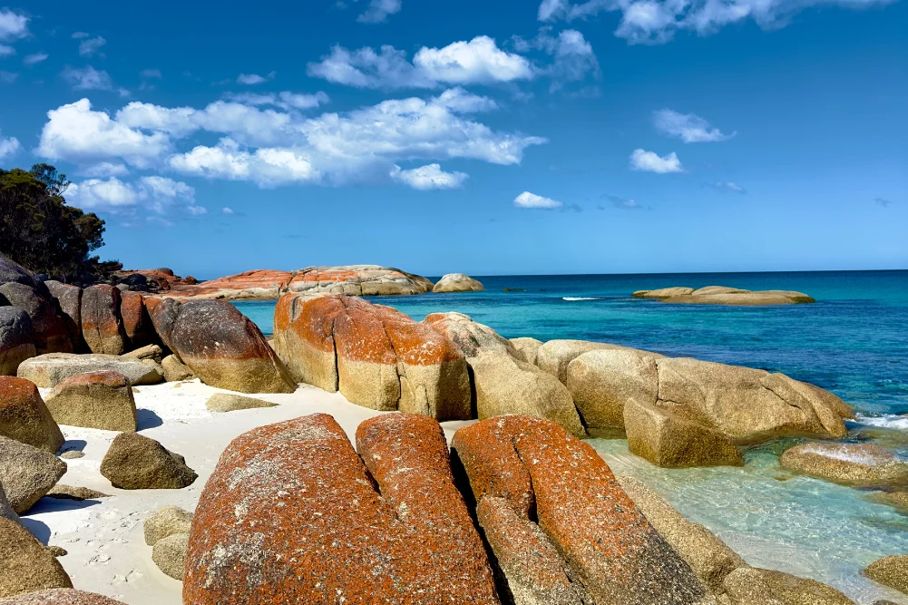
Kalbarri: The Convergence of Gorges and Sea
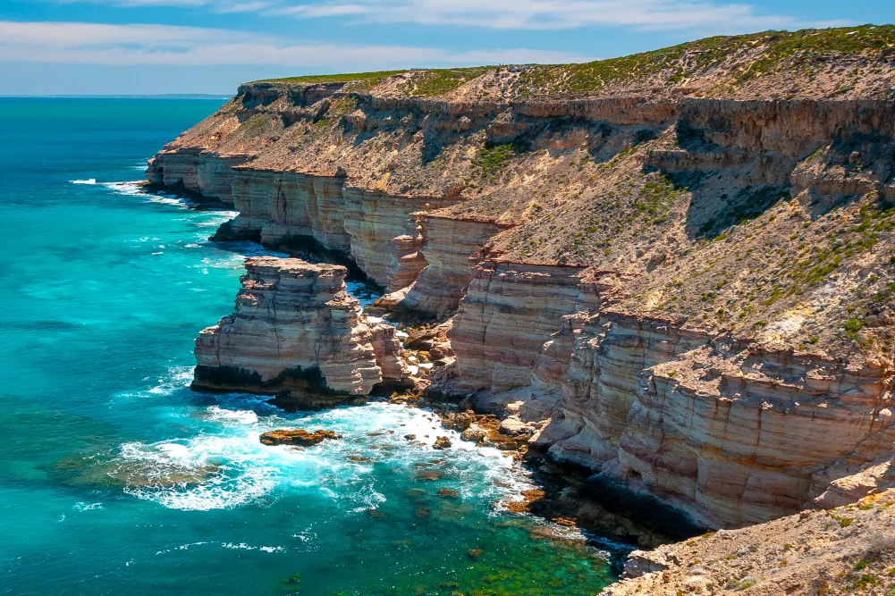
The journey concludes in Kalbarri, where the Murchison River meets the Indian Ocean. Kalbarri National Park, spanning over 183,000 hectares, is characterized by its red sandstone gorges and dramatic sea cliffs. The 2020 opening of the Kalbarri Skywalk—two cantilevered platforms hanging 100 meters above the Murchison Gorge—represented a $24 million investment in the state’s tourism infrastructure.
The park is also a site of geological interest, featuring Skolithos fossils—ancient worm burrows dating back 400 million years. Despite the devastation caused by Tropical Cyclone Seroja in 2021, which damaged approximately 70% of the town’s structures, Kalbarri has undergone a rapid recovery. The resilience of the local tourism sector is evidenced by the return of visitor numbers to pre-cyclone levels, supported by the diverse range of activities from hiking the "Loop Trail" to snorkeling at the Blue Holes.
Infrastructure Development and Future Economic Projections
The development of the Indian Ocean Drive and the subsequent enrichment of the Coral Coast’s tourism offerings represent a strategic success for Western Australian regional development. By connecting isolated natural wonders with high-quality road infrastructure, the state has secured a sustainable source of regional income.
Looking forward, the focus of regional authorities is shifting toward environmental sustainability. With the increasing threat of coastal erosion and the delicate nature of the wildflower ecosystems, the DBCA and local shires are investing in "low-impact" tourism models. This includes the expansion of eco-certified accommodations and the implementation of stricter visitor management systems at high-traffic sites like Nature’s Window.
The Indian Ocean adventure, covering less than 600 kilometers from Perth, is more than a scenic route; it is a vital artery for Western Australia’s cultural heritage, scientific research, and economic stability. As the state continues to promote the "West is Best" narrative, the Turquoise Trail stands as the benchmark for how natural beauty and modern infrastructure can coexist to the benefit of both the environment and the economy.