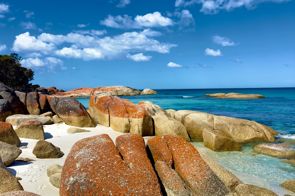
Situated approximately 150 kilometers east of Darwin, the Mary River Wetlands represent one of the most ecologically diverse and significant regions within Australia’s Northern Territory. Known for harboring the highest concentration of estuarine (saltwater) crocodiles in the world, the Mary River National Park serves as a critical sanctuary for both apex predators and a vast array of migratory bird species. Unlike the more commercialized "jumping crocodile" tours closer to the city, the Mary River offers a raw, primitive experience that attracts anglers, conservationists, and nature enthusiasts seeking an immersive encounter with the Top End’s wilderness. The landscape is a complex tapestry of lily-fringed lagoons, verdant floodplains, monsoon forests, and tidal reaches that connect the freshwater systems to the Arafura Sea.
The Ecological Significance of the Mary River Catchment
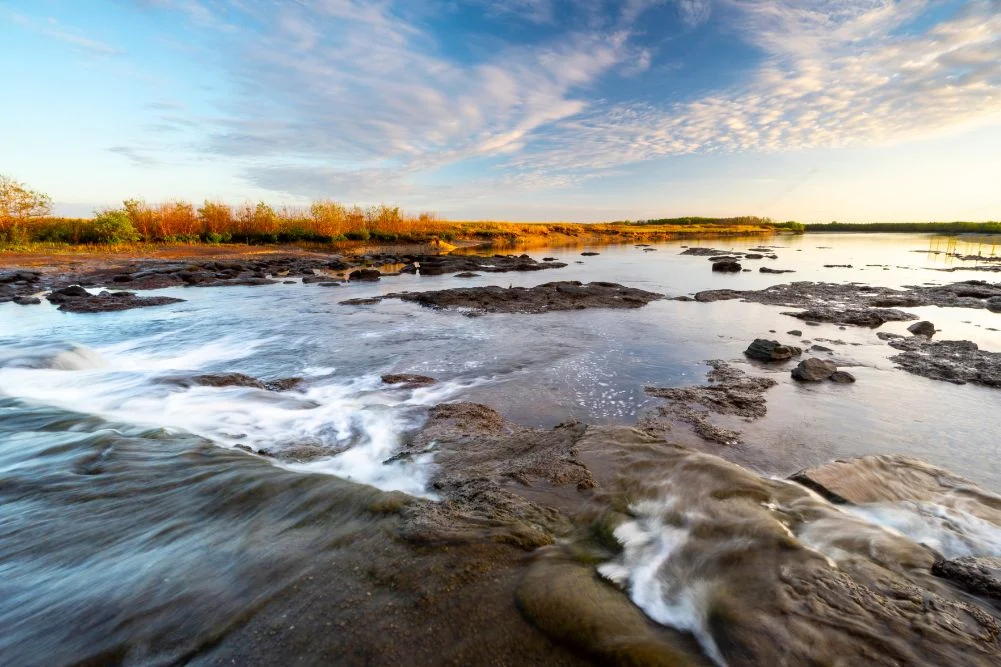
The Mary River catchment covers an area of approximately 8,000 square kilometers. Its importance lies in its unique hydrological structure, which transitions from coastal mangroves to inland freshwater marshes. This transition zone is a breeding ground for the iconic Barramundi (Lates calcarifer) and a vital habitat for the Magpie Goose (Anseranas semipalmata). During the tropical wet season (November to April), the region is transformed into a massive inland sea, while the dry season (May to October) concentrates wildlife around permanent water bodies known as billabongs.
Research conducted by the Northern Territory’s Department of Environment, Parks, and Water Security indicates that the Mary River system is home to an estimated five to seven saltwater crocodiles per kilometer in certain stretches. This density exceeds that of the more famous Kakadu National Park, making it a focal point for crocodilian research and management. The park’s biodiversity is further bolstered by its monsoon forests, which provide refuge for the Orange-footed Scrubfowl and various species of flying foxes.
Historical Context: From Exploration to Conservation
The human history of the Mary River is as rugged as its landscape. In 1862, the pioneering explorer John McDouall Stuart reached the banks of the Mary River during his sixth and final expedition. Stuart had successfully navigated a 3,540-kilometer route from Port Augusta in South Australia to the northern coast, effectively opening the Australian interior for future telegraph lines and pastoral development. Shady Camp, a primary hub within the park today, was named by Stuart as a place of respite before he reached the sea at Point Stuart.
In the late 20th century, the wetlands faced a severe environmental crisis. Overgrazing by feral water buffalo and the natural expansion of tidal channels led to massive saltwater intrusion into freshwater ecosystems. This intrusion killed large swaths of paperbark forests and destroyed freshwater habitats. In response, the Northern Territory government and local land managers constructed a series of barrages in the late 1980s. The most notable of these is the skinny concrete dam at Shady Camp, designed to prevent saltwater from pushing upstream during high tides while allowing freshwater to flow out during the wet season "run-off."
The Shady Camp Barrage and the Barramundi Run-off
The Shady Camp barrage has become an unintended theater for one of nature’s most intense spectacles. During the "run-off"—the period at the end of the wet season when floodwaters recede—thousands of fish are flushed from the floodplains into the main river channel. As these fish are swept over the barrage, they become easy prey for both human anglers and saltwater crocodiles.
The economic impact of this phenomenon is substantial. Recreational fishing in the Northern Territory is estimated to contribute over $270 million annually to the local economy, with the Mary River being a primary destination. Anglers frequently stand on or near the barrage, casting lines for trophy-sized Barramundi, often while large crocodiles circle just meters away. This proximity has necessitated strict safety protocols and the "Be Crocwise" public awareness campaign, as the predatory behavior of the Crocodylus porosus is a constant factor in the region.
Biodiversity and Avian Habitats
While the crocodiles and Barramundi dominate the headlines, the Mary River Wetlands are a premier destination for ornithologists. The "Jesus bird," or Comb-crested Jacana, is a frequent sight, utilizing its elongated toes to walk across the floating leaves of pink lotus lilies. The wetlands also host:
- Magpie Geese: During the late dry season, tens of thousands of these birds congregate in the remaining wetlands to feed on water chestnuts.
- Jabiru (Black-necked Stork): Australia’s only stork species can be found foraging in the shallow fringes.
- Predatory Birds: White-bellied Sea Eagles and Whistling Kites are common, often seen competing with crocodiles for fish near the Shady Camp barrage.
The Brian Creek and Jimmy Creek monsoon forest walks provide a stark contrast to the open wetlands. these shaded corridors are home to banyan trees and epiphytic ferns, providing a microclimate that supports species not found in the surrounding savannah.
Infrastructure and Visitor Management
To manage the influx of tourists while preserving the delicate ecosystem, the Northern Territory Parks and Wildlife Commission has developed several key sites:
Shady Camp
This remains the most popular site for fishing and crocodile viewing. It offers rustic camping facilities, boat ramps, and a viewing platform. However, it is also known for high mosquito activity, particularly at dusk, necessitating robust insect protection for overnight visitors.
Couzens Lookout
Located on a high bank overlooking a sweeping bend of the Mary River, Couzens Lookout offers a more tranquil camping experience. It is favored for its sunset views and proximity to the Rockhole Billabong. The campground features picnic tables, fire pits, and accessible toilets, catering to a wider demographic of campers.
Mistake Billabong
This permanent waterhole features a secluded bird hide. It serves as a critical refuge for wildlife during the height of the dry season and provides photographers with clear vantage points of floodplain monitors and agile wallabies.
Point Stuart Wilderness Lodge
For visitors seeking more comfort, this private facility offers lodge rooms and safari tents. It serves as a logistics hub, providing guided fishing safaris and wetland cruises that navigate the Rockhole Billabong and the Mary River mouth at Chambers Bay.
Analysis of Environmental Challenges
The management of the Mary River Wetlands involves a delicate balance between recreational use and conservation. Saltwater intrusion remains a persistent threat, exacerbated by rising sea levels and the potential for storm surges to overtop existing barrages. Furthermore, the management of invasive species, such as mimosa (Mimosa pigra) and feral pigs, requires ongoing investment.
The Northern Territory government’s 2023-2024 budget allocations for park management emphasize the maintenance of access roads and the upgrading of visitor facilities to ensure the region remains a viable tourism pillar. However, environmentalists argue that more rigorous monitoring of water quality and fish stocks is needed to ensure the long-term sustainability of the Barramundi population, which faces pressure from both recreational and commercial fishing interests.
Travel Logistics and Safety Information
Access to the Mary River National Park is highly seasonal. The primary tourist window is the dry season, from May to September. During this time, temperatures typically range from 20°C to 31°C, and most tracks are accessible to conventional vehicles.
- Access: The park is reached via the Arnhem Highway. Shady Camp is located 50km north of the highway on Point Stuart Road.
- Fees: A Northern Territory Parks Pass is required for all visitors. As of 2024, daily entry is approximately $10 for adults, with multi-day and family passes available.
- Safety: Swimming is strictly prohibited in all areas of the Mary River National Park due to the high risk of crocodile attacks. Visitors are advised to stay at least five meters back from the water’s edge when fishing or observing wildlife.
- Supplies: While some lodges offer meals and fuel, campers must be self-sufficient, carrying adequate drinking water, firewood, and medical supplies.
The Mary River Wetlands stand as a testament to the resilience of the Australian Top End. From its history as a challenging frontier for 19th-century explorers to its current status as a world-class fishing and wildlife destination, the region continues to provide a vital link between the Northern Territory’s economic interests and its environmental heritage. For the traveler, it offers a rare opportunity to witness an apex-predator-dominated ecosystem that remains largely unchanged by the passage of time.