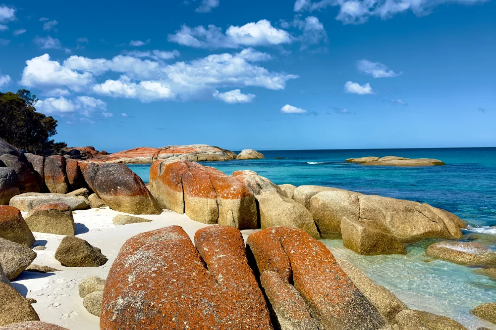
The Indian Ocean Drive, a critical infrastructure project completed in 2010 to link Lancelin and Geraldton, has become a primary artery for Western Australia’s tourism sector, facilitating access to the diverse ecological and geological wonders of the Coral Coast. Stretching approximately 270 kilometers from the northern fringes of the Perth metropolitan area to the Brand Highway, the route serves as the gateway to a region defined by its ancient limestone formations, vibrant marine ecosystems, and significant Indigenous heritage. For the state’s economy, this corridor is more than a scenic bypass; it is a vital link for the multi-million dollar western rock lobster industry and a growing international tourism market that seeks the unique juxtaposition of arid desert landscapes and the temperate waters of the Indian Ocean.
Regional Chronology and the Development of the Coastal Corridor
The development of the Indian Ocean Drive was a strategic initiative by the Western Australian government to divert traffic from the inland Brand Highway, providing a more direct and visually engaging route for travelers. Historically, the coastal towns between Lancelin and Dongara were isolated fishing hamlets accessible only by unsealed roads or long inland detours. The completion of the sealed road has seen a 30% increase in regional visitation over the last decade, according to Tourism Western Australia data. This accessibility has allowed for a structured exploration of the coastline, beginning with the sand-dominated landscapes of the south and culminating in the rugged gorge country of Kalbarri National Park.
The journey begins 55 kilometers north of Perth’s Central Business District. As travelers move northward, the landscape transitions from suburban sprawl to the undulating white dunes of Lancelin. Known as Wangaree in the local Yued Indigenous language, Lancelin serves as a pivotal hub for both adventure tourism and commercial fishing. The town’s economy is heavily bolstered by the Western Rock Lobster (Panulirus cygnus) industry, which remains one of Australia’s most valuable single-species fisheries, contributing over $400 million annually to the state’s economy.
Geological and Indigenous Significance of the Nambung National Park
Continuing north, the route enters the Nambung National Park, home to the Pinnacles Desert. These limestone spires, some reaching heights of four meters, are the result of thousands of years of geological weathering. Formed from the remains of sea shells in an earlier era when the land was submerged, the pillars were exposed as the surrounding quartz sands were blown away by prevailing winds.
The site holds profound significance for the Yued people. According to traditional folklore, the Pinnacles are tied to the Wagyl, the Rainbow Serpent, a central creator being in Noongar culture. The Wagyl is credited with carving the landscape and its waterways, leaving the spires as markers of its passage. Modern management of the park by the Department of Biodiversity, Conservation and Attractions (DBCA) emphasizes this cultural connection, integrating traditional ecological knowledge with contemporary conservation efforts. The Pinnacles remain a premier international drawcard, attracting over 250,000 visitors annually prior to global travel shifts, underscoring the site’s role as a cornerstone of regional tourism.
Marine Conservation and the Jurien Bay Ecosystem
The town of Jurien Bay represents a critical point in the marine conservation efforts of the Mid-West region. The Jurien Bay Marine Park, established in 2003, protects a diverse range of habitats, including seagrass meadows, reef systems, and offshore islands. These islands—specifically Buller Island, North Fisherman Island, and Essex Rocks—are vital breeding grounds for the Australian Sea Lion (Neophoca cinerea), one of the rarest seal species in the world.
Data from the Australian Department of Climate Change, Energy, the Environment and Water indicates that the Australian Sea Lion is currently listed as endangered. Consequently, human interaction is strictly regulated. Tourism operators in Jurien Bay function under stringent licensing to ensure that "swim with sea lion" experiences do not disrupt breeding cycles or natural behaviors. This regulated tourism model provides a sustainable economic stream for the town while funding ongoing research and monitoring of the colonies.
Inland Explorations: The Stockyard Gully Karst System
While the Indian Ocean Drive is celebrated for its coastal views, the hinterland between Leeman and Green Head contains significant karst topography. Stockyard Gully National Park features a 250-meter-long limestone tunnel formed by an ancient river system. Historically, this cave was used by stockmen in the 19th century as a natural holding pen for cattle being driven along the Old North Road to the northern markets.
The gully is characterized by its unique microclimate, supporting flora such as the Zamia palm and various species of Banksia. The region is also a focal point for Western Australia’s world-renowned wildflower season, which peaks between July and October. The state’s flora is among the most diverse on Earth, with over 12,000 species, 60% of which are found nowhere else. The "Everlasting" daisies (Rhodanthe chlorocephala) and the rare Wreath Flower (Lechenaultia macrantha) attract significant numbers of botanical tourists, contributing to the "Wildflower Way" economic sub-sector.
Maritime History and the HMAS Sydney II Memorial
The port city of Geraldton serves as the administrative and historical heart of the Mid-West. Its maritime history is marked by both commercial success and profound tragedy. The Museum of Geraldton houses artifacts from several 17th and 18th-century Dutch East India Company (VOC) shipwrecks, including the Batavia and the Gilt Dragon (Vergulde Draeck). These wrecks are reminders of the "Roaring Forties" winds that drove European explorers toward the treacherous reefs of the Western Australian coast.
A more contemporary site of historical importance is the HMAS Sydney II Memorial. Situated on Mount Scott, the memorial commemorates the loss of the light cruiser and its 645 crew members following a battle with the German auxiliary cruiser Kormoran in November 1941. The wreckage of the ship was not discovered until 2008, approximately 200 kilometers off the coast. The memorial serves as a "National Shrine" and is a focal point for commemorative services, reinforcing Geraldton’s identity as a city deeply connected to the sea.
Biochemical Wonders: The Science of Hutt Lagoon
North of Geraldton lies Hutt Lagoon, a salt lake famous for its distinct pink hue. This coloration is not the result of pollution but is a biological phenomenon caused by the presence of the carotenoid-producing algae Dunaliella salina. The lagoon is the site of the world’s largest microalgae production plant, managed by BASF.
The algae are harvested for their high beta-carotene content, which is used as a natural food coloring and a source of Vitamin A in dietary supplements. The intensity of the lagoon’s pink color fluctuates based on salinity levels, temperature, and light intensity, making it a subject of interest for both industrial biotechnologists and landscape photographers. The commercialization of the lagoon’s natural resources demonstrates the diverse industrial base of the Coral Coast beyond traditional mining and agriculture.
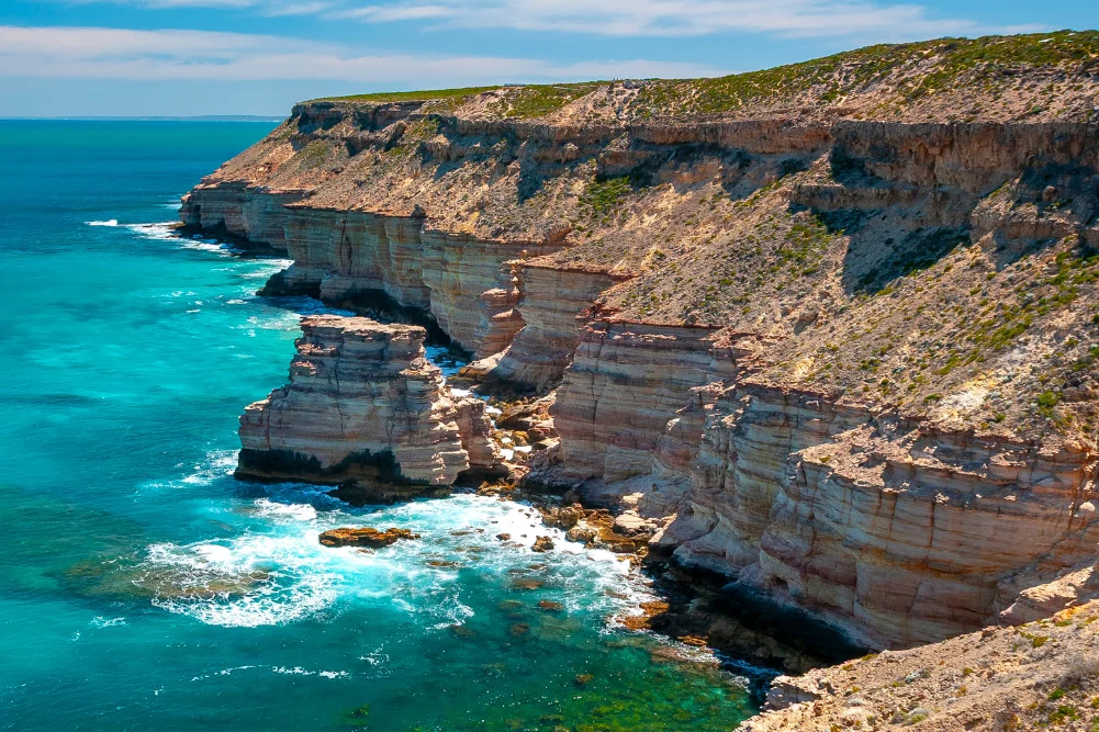
Kalbarri and the Murchison River Infrastructure
The journey concludes in Kalbarri, where the Murchison River meets the Indian Ocean. The region is defined by the contrast between the 400-million-year-old Tumblagooda Sandstone gorges and the modern tourism infrastructure. In 2020, the Western Australian government opened the Kalbarri Skywalk (Kaju Yatka), a $24 million project featuring two cantilevered walkways that project 25 and 17 meters over the Murchison Gorge.
This infrastructure investment was designed to enhance the visitor experience while managing the environmental impact on the national park. The Skywalk provides views of "Nature’s Window" and the Z-Bend, geological features that showcase the erosive power of the Murchison River over millennia. According to the DBCA, the Skywalk has significantly increased the average length of stay for visitors in Kalbarri, providing a boost to local hospitality businesses such as the iconic Finlay’s Kalbarri and various eco-accommodation providers.
Broader Implications and Safety Analysis
The Indian Ocean Drive and its northern extensions represent a successful model of regional development through infrastructure. However, the route’s popularity has necessitated ongoing safety assessments. The Road Safety Commission of Western Australia has frequently reviewed the drive due to its high volume of tourist traffic, including international visitors who may be unfamiliar with rural driving conditions. Recent upgrades have included the installation of audible edge lines (rumble strips) and additional overtaking lanes to mitigate the risk of head-on collisions.
From an environmental perspective, the increased traffic poses challenges for the preservation of the delicate coastal heathlands. The "Leave No Trace" campaign and the strict enforcement of 4WD-only zones in areas like Stockyard Gully are essential to maintaining the ecological integrity that attracts tourists in the first place.
In conclusion, the corridor from Perth to Kalbarri is a microcosm of Western Australia’s broader identity. It balances the economic imperatives of the fishing and biotechnology industries with the cultural responsibilities of Indigenous heritage and environmental conservation. As the state continues to diversify its economy, the Indian Ocean Drive stands as a testament to the enduring value of the natural world as both a scientific resource and a global destination. The integration of modern infrastructure, such as the Kalbarri Skywalk, with ancient landscapes ensures that the Coral Coast remains a resilient and vital part of Australia’s national heritage.