Located approximately 150 kilometers east of Darwin, the Mary River National Park represents one of the most significant and ecologically diverse wetland systems in Australia’s Northern Territory. Known for harboring the highest concentration of estuarine crocodiles (Crocodylus porosus) in the world, the region serves as a critical sanctuary for biodiversity, a hub for recreational fishing, and a testament to the complex history of Australian exploration. The park encompasses a vast array of landscapes, including lily-fringed lagoons, verdant floodplains, dense monsoon forests, and tidal reaches lined with mangroves. These ecosystems are not only vital for local flora and fauna but also form a cornerstone of the Northern Territory’s nature-based tourism industry, which attracts thousands of domestic and international visitors annually during the dry season.
Ecological Framework and the Shady Camp Barrage
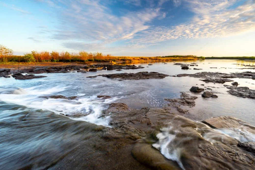
The hydrological health of the Mary River Wetlands is managed through a combination of natural cycles and human intervention. A defining feature of the park’s infrastructure is the Shady Camp barrage, a concrete structure commissioned in the late 1980s. The primary objective of this barrage was to mitigate the detrimental effects of saltwater intrusion into the sensitive freshwater habitats located upstream. During the mid-20th century, feral buffalo populations decimated native vegetation, creating swim-paths that allowed saltwater to penetrate deep into freshwater marshes, killing large swathes of paperbark forests and altering the delicate balance of the wetlands.
While the barrage serves as a physical barrier against tidal saltwater flow, it remains a porous boundary for the region’s apex predators. Estuarine crocodiles frequently traverse the structure, moving between the tidal reaches and the freshwater pools. This movement creates a unique ecological spectacle, particularly during the "run-off" season, when floodwaters from the inland marshes drain back toward the Arafura Sea. The resulting concentration of nutrients and prey at the barrage makes it a focal point for both natural predation and human activity.
The Economic and Cultural Impact of the Barramundi Run-off
The Northern Territory’s recreational fishing sector is a significant contributor to the regional economy, with the Mary River serving as one of its most productive arteries. The phenomenon known as the "run-off"—typically occurring between March and May—is characterized by the rapid drainage of the wetlands following the monsoon rains. As water levels recede, vast numbers of fish, including the highly prized barramundi (Lates calcarifer), are funneled through the river systems.
Data from the Northern Territory Government indicates that recreational fishing generates over $100 million in annual expenditure across the territory. At Shady Camp, the intersection of the freshwater wetlands and the tidal river creates a high-energy environment where anglers compete with crocodiles for barramundi. This seasonal surge in activity supports local businesses, including charter operators, equipment suppliers, and hospitality providers such as the Point Stuart Wilderness Lodge.
Beyond barramundi, the river system supports various other species, including the spotted saratoga, sooty grunter, and tarpon. The ecological productivity of the Mary River is further evidenced by the presence of diverse avian predators. Sea eagles, cormorants, and nankeen night herons are frequently observed utilizing the barrage as a hunting ground, taking advantage of the fish forced over the concrete barrier by the rushing current.
Chronology of Exploration and Historical Context
The historical significance of the Mary River region is inextricably linked to the expedition of John McDouall Stuart, one of Australia’s most prominent explorers. In 1862, Stuart led a party on a 3,540-kilometer journey from Port Augusta in South Australia to the northern coast, aiming to chart a route across the continent’s interior.
On July 23, 1862, Stuart and his team arrived at the banks of the Mary River, establishing a camp that he named "Shady Camp" due to the respite provided by the dense vegetation. The following day, the party reached the Arafura Sea at Chambers Bay, marking the successful completion of the first European crossing of the Australian continent from south to north. This feat paved the way for the establishment of the Australian Overland Telegraph Line and the eventual development of Darwin as a northern gateway.
Today, the park preserves this history through memorials and trails. The Stuart’s Tree Memorial Cairn, located near Point Stuart, serves as a permanent marker of the expedition’s northern terminus. However, access to these historical sites remains contingent on the seasonal climate, as the tracks to Point Stuart are often submerged or impassable during the wet season.
Biodiversity and Avian Populations
The Mary River Wetlands are recognized internationally as an Important Bird Area (IBA). The region provides a critical habitat for a staggering array of bird species, many of which congregate in massive numbers during the dry season as smaller water bodies elsewhere in the territory dry up.
Among the most iconic residents is the Magpie Goose (Anseranas semipalmata). During the late dry season, the floodplains can host tens of thousands of these birds, which forage on the tubers of water lilies and sedges. Other notable species include:
- Comb-crested Jacana: Often referred to as "Jesus birds" for their ability to walk on floating lily pads.
- Black-necked Stork (Jabiru): Australia’s only stork species, frequently seen foraging in the shallows of Mistake Billabong.
- Brolga: Large cranes known for their elaborate mating dances.
- Rainbow Bee-eater: Vibrant aerial hunters that nest in the sandy banks of the river.
The terrestrial environment surrounding the wetlands is equally biodiverse. Agile wallabies are common along the grassy verges, while the monsoon forests of Jimmy Creek and Brian Creek house the orange-footed scrub fowl. These birds are known for constructing massive nesting mounds of decomposing organic matter, which can reach several meters in height.
Infrastructure and Visitor Management
To manage the influx of visitors while preserving the ecological integrity of the park, the Northern Territory Parks and Wildlife Commission maintains a network of campgrounds and facilities. Locations such as Couzens Lookout and Shady Camp provide basic amenities, including fire pits and solar-powered lighting, though visitors are required to be largely self-sufficient.
Current management policies emphasize "Crocwise" behavior—a public safety initiative designed to educate visitors on the dangers posed by estuarine crocodiles. Given that the Mary River system has the highest density of these predators globally, safety protocols are strictly enforced. Anglers are advised to stay well back from the water’s edge, and swimming is prohibited throughout the park.
The Point Stuart Wilderness Lodge serves as a primary private infrastructure hub, offering a range of accommodations from safari tents to lodge rooms. The lodge also facilitates guided tours and boat rentals, allowing visitors to navigate the Rockhole Billabong and the complex maze of freshwater channels that comprise the 30 kilometers of wetlands.
Broader Environmental Implications and Conservation Analysis
The long-term sustainability of the Mary River Wetlands faces several challenges, primarily related to climate change and invasive species. Rising sea levels pose a significant threat to the Shady Camp barrage; if the structure is breached by increasing tidal heights, the resulting saltwater intrusion could once again devastate the freshwater ecosystems that have spent decades recovering.
Furthermore, the management of invasive flora, such as mimosa (Mimosa pigra) and salvinia (Salvinia molesta), requires constant vigilance. These weeds have the potential to choke waterways and outcompete native vegetation, which would lead to a decline in the bird and fish populations that define the park’s character.
From a conservation perspective, the Mary River National Park serves as a laboratory for wetland restoration. The success of the barrage in the 1980s demonstrated that targeted engineering interventions could reverse ecological degradation. However, environmentalists argue that a more holistic approach—incorporating traditional indigenous land management practices and more aggressive carbon mitigation strategies—is necessary to ensure the wetlands remain resilient in the 21st century.
Conclusion and Future Outlook
The Mary River Wetlands remain a vital component of the Northern Territory’s natural heritage. The park’s ability to balance the demands of high-intensity recreational fishing with the requirements of a sensitive wildlife sanctuary is a testament to effective, though complex, land management. As tourism in the Top End continues to evolve, the Mary River will likely remain a premier destination for those seeking a primitive and authentic encounter with the Australian wilderness.
For the scientific community, the park offers unparalleled opportunities to study apex predator behavior and wetland dynamics. For the public, it provides a window into the historical journey of John McDouall Stuart and the raw beauty of a landscape that has remained largely unchanged for millennia. As long as the seasonal cycle of the monsoon continues to replenish these floodplains, the Mary River will continue to be a thriving, albeit dangerous, theater of natural history.