Western Australia’s Indian Ocean Drive represents one of the most significant tourism and ecological corridors in the Southern Hemisphere, stretching from the northern fringes of Perth to the rugged landscapes of Kalbarri. This 600-kilometer route serves as a critical artery for regional commerce, biodiversity conservation, and international tourism, showcasing a unique intersection of Mediterranean and semi-arid climates. Characterized by the annual wildflower bloom, ancient geological formations, and a rich maritime history, the region attracts hundreds of thousands of visitors annually, contributing significantly to the state’s multi-billion dollar tourism industry. The journey follows a trajectory of increasing geographical drama, moving from the white sand dunes of Lancelin to the ancient limestone spires of the Pinnacles, and eventually to the dramatic red sandstone gorges of Kalbarri National Park.
The Lancelin Adventure Hub and the Western Rock Lobster Industry
The town of Lancelin, known traditionally by its Yued Indigenous name "Wangaree" (meaning fish), serves as the first major waypoint on the Indian Ocean Drive. Beyond its reputation as a premier destination for windsurfing and kiteboarding due to the reliable "Fremantle Doctor" sea breezes, Lancelin is a vital hub for the Western Rock Lobster (Panulirus cygnus) industry. This fishery is the most valuable single-species fishery in Australia, consistently achieving Marine Stewardship Council (MSC) certification for sustainability. The local economy is deeply intertwined with the sea, supporting both commercial fishing fleets and recreational tourism.
Geographically, Lancelin is defined by its massive, shifting sand dunes, which extend for approximately two kilometers along the northern edge of the township. These dunes, some reaching heights that provide panoramic views of the Indian Ocean, are a major draw for adventure tourism, including sandboarding and off-road vehicle excursions. Offshore, the Lancelin Island Nature Reserve provides a sanctuary for diverse avian species and the Australian sea lion. The surrounding waters are also a graveyard for maritime history, containing at least 14 known shipwrecks, which now form a complex reef system supporting a vibrant underwater ecosystem.
Geological Evolution and the Nambung National Park
Located near the town of Cervantes, the Pinnacles Desert within Nambung National Park stands as one of Western Australia’s most iconic natural landmarks. These thousands of weathered limestone pillars, some rising up to four meters high, were formed approximately 25,000 to 30,000 years ago after the sea receded and left deposits of sea shells. Over millennia, coastal winds removed the surrounding sand, leaving the pillars exposed. To the Yued people, these spires are woven into the "Dreaming" stories of Wagyl, the rainbow serpent, who shaped the landscape of the Mid West.
The park is a study in biodiversity, where Western grey kangaroos and emus are frequently sighted grazing among the acacias. Tourism data suggests that the Pinnacles Desert remains one of the most visited natural sites in the state, necessitating careful management of the Pinnacles Desert Loop Drive to balance visitor access with environmental preservation. The site’s historical intrigue dates back to early Dutch explorers, who reportedly mistook the spires for the ruins of an ancient city, a testament to the surreal nature of the landscape.
Marine Conservation and the Jurien Bay Ecosystem
Further north, Jurien Bay emerges as a focal point for marine conservation and eco-tourism. The Jurien Bay Marine Park protects a massive limestone reef system that parallels the coast, creating extensive seagrass meadows. These meadows are essential nurseries for the Western Rock Lobster and provide habitat for a diverse range of marine life. A primary biological highlight of the region is the presence of the Australian sea lion (Neophoca cinerea), one of the rarest sea lion species in the world. Breeding colonies are found on Buller, North Fisherman, and Essex Rocks, where access is strictly regulated by the Department of Biodiversity, Conservation and Attractions (DBCA) to ensure the protection of these threatened pinnipeds.
Jurien Bay has also invested in artificial reef technology to enhance local biodiversity and tourism. The underwater snorkelling trail at the old Jetty features interpretive signage anchored to the sea floor, educating divers on the various coral "bommies" and fish species inhabiting the area. This integration of education and recreation is a hallmark of the region’s approach to sustainable tourism.
Subterranean Exploration and the Maritime History of Green Head
The transition from marine to terrestrial adventure continues at Green Head, home to Dynamite Bay. The bay’s name is a literal reference to 1960s-era treasure hunters who used explosives to recover silver from the shipwrecked Vergulde Draeck (Gilt Dragon), a Dutch East India Company vessel that sank in 1656. This history highlights the treacherous nature of the WA coastline, which has claimed hundreds of vessels over the centuries.
Inland from Green Head lies Stockyard Gully National Park, which features a 250-meter-long limestone tunnel. This cave system, formed by an ancient riverbed, serves as a cool refuge during the summer months. The gully is a botanical hotspot, featuring Queen of Sheba orchids, yellow leschenaultia, and various banksia species. These plants support a delicate food web, including honeyeaters and the elusive honey possum. Access to this area is strictly limited to four-wheel-drive vehicles, preserving the rugged, off-the-beaten-path character of the Mid West.
Geraldton: A Center for Heritage and Commemoration
As the Indian Ocean Drive merges into the Brand Highway, Geraldton serves as the regional capital and a site of profound historical significance. The Western Australian Museum in Geraldton houses artifacts from several 17th and 18th-century Dutch shipwrecks, including the Batavia, whose tale of mutiny and survival remains one of the most harrowing in maritime history.
Geraldton also plays a critical role in Australia’s military commemoration. The HMAS Sydney II Memorial, located on Mount Scott, honors the 645 sailors lost in 1941 during a World War II battle with the German raider Kormoran. The memorial serves as a somber reminder of the ocean’s power and the region’s strategic importance during global conflicts. The discovery of the wreck in 2008, approximately 200 kilometers off the coast, provided closure to a mystery that had endured for over six decades.
Botanical Diversity and the Science of Hutt Lagoon
North of Geraldton, the landscape shifts toward the Chapman Valley and Northampton, areas renowned for their extraordinary floral diversity. Western Australia is home to over 12,000 species of wildflowers, 60% of which are found nowhere else on Earth. The "wreath flower" (Lechenaultia macrantha) is a particular draw for botanical enthusiasts, growing in perfect circular garlands on the sandy soil.
The route also passes Hutt Lagoon, a 14-kilometer-long salt lake famous for its vivid pink hue. This coloration is caused by the presence of the carotenoid-producing algae Dunaliella salina. The lagoon is not merely a visual marvel but also a commercial asset; it contains the world’s largest microalgae production plant, where beta-carotene is harvested for use in food coloring and vitamin supplements. The intensity of the pink varies based on salinity levels, temperature, and light, creating a dynamic landscape that shifts from lilac to hot pink.
Kalbarri and the Murchison River Frontier
The expedition concludes at Kalbarri, where the Murchison River meets the Indian Ocean. Kalbarri National Park covers over 183,000 hectares and features dramatic red sandstone gorges carved over 400 million years. The park’s recent infrastructure upgrades, including the twin Kalbarri Skywalks (Kaju Yatka), allow visitors to project over the edge of the gorge, 100 meters above the riverbed. This engineering feat has significantly boosted the region’s capacity for high-volume tourism while minimizing the physical footprint on the fragile gorge edges.
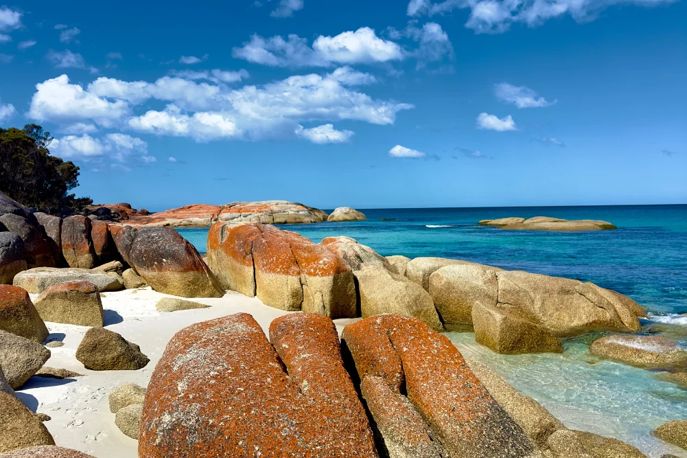
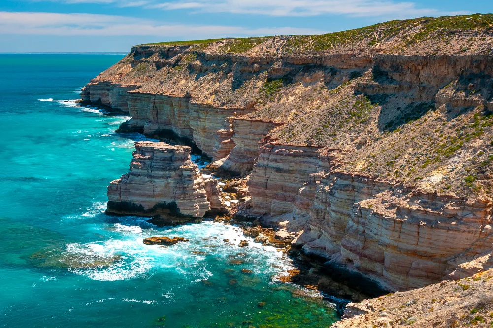
The coastal cliffs of Kalbarri, such as Eagle Gorge and Castle Cove, offer a different geological perspective, showcasing the power of the Southern Ocean in shaping the continent. At Jakes Point, a National Surfing Reserve, the interaction between the rugged coastline and the ocean swells creates world-class surfing conditions. The town of Kalbarri itself serves as a resilient tourism hub, having undergone significant reconstruction following the devastation of Cyclone Seroja in 2021.
Economic and Environmental Implications
The development and promotion of the Indian Ocean Drive have profound implications for Western Australia’s regional economy. By providing a sealed, accessible route between Perth and the Mid West, the state government has facilitated a "road trip" culture that sustains small coastal communities. However, this increased accessibility brings challenges in environmental management.
State authorities, including Tourism WA and the DBCA, emphasize the importance of "Leave No Trace" principles. The fragile desert ecosystems and the sensitive breeding grounds of sea lions require constant monitoring to prevent degradation. Furthermore, the economic reliance on seasonal events—such as the July-to-October wildflower bloom—necessitates a strategic approach to off-peak tourism, focusing on year-round assets like the Kalbarri Skywalk and Geraldton’s heritage sites.
In conclusion, the Indian Ocean Drive is more than a scenic route; it is a complex tapestry of geological history, biological diversity, and cultural heritage. From the salt pans and ancient stromatolites to the modern-day engineering of skywalks and microalgae farms, the region represents the best of Western Australia’s natural and innovative spirit. As global interest in eco-tourism and adventure travel continues to grow, this 600-kilometer stretch of coastline remains a vital asset for the state, offering a masterclass in the balance between human exploration and environmental stewardship.