 Walid Sujud Trenggono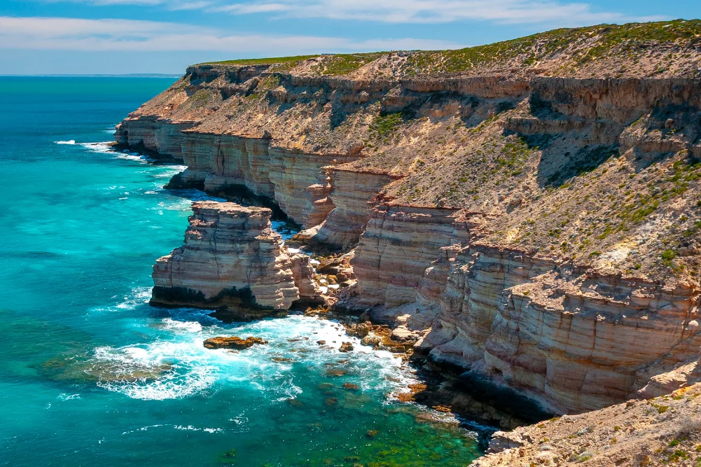
As the final winter rains recede north of Perth, the highway unfurls toward a dramatic convergence of ancient geological formations, vibrant coastal ecosystems, and the crystalline expanse of the Indian Ocean. Stretching along the state’s scenic western corridor, the route from Lancelin to Kalbarri via the fully sealed Indian Ocean Drive offers an unparalleled look into one of Australia’s most ecologically diverse regions. For travelers, conservationists, and regional economists alike, this 600-kilometer stretch serves as a vital artery for domestic tourism, blending high-adrenaline adventure with fragile, protected natural wonders.
Route Overview and Regional Economic Impact
The journey departs approximately 55 kilometers north of Perth’s Central Business District, bridging Yanchep and Dongara over 270 kilometers of modern bitumen, with an additional 230 kilometers required to reach Kalbarri further north. Inaugurated to improve regional connectivity and boost the tourism economy of the Mid West and Wheatbelt regions, the Indian Ocean Drive has significantly reduced travel times for visitors seeking access to marine parks, national reserves, and remote coastal hamlets.
According to regional tourism stakeholders, the influx of visitors between the peak wildflower and whale-migration window of July through October injects millions of dollars annually into local economies. Small businesses spanning from Cervantes to Green Head rely heavily on this seasonal transition, capitalizing on an increasing global demand for experiential, nature-based travel that balances environmental conservation with recreational access.
Chronology of the Coast: From Maritime Tragedies to Indigenous Heritage
The cultural and maritime history of the Coral Coast is as deep as its offshore trenches. Long before European cartographers charted these treacherous waters, the region was stewarded by the Yued people of the Noongar nation. Indigenous oral histories anchor the landscape in antiquity, detailing the journeys of ancestral beings such as Wagyl, the rainbow serpent, who is said to have carved out local rivers, salt pans, and the iconic limestone spires of the Swan Coastal Plain.
In the 17th and 18th centuries, the coastline transitioned from a pristine Indigenous domain into a maritime graveyard for the Dutch East India Company (VOC) and other European seafaring nations. Navigational errors and fierce coastal gales resulted in numerous high-profile shipwrecks, most notably the Vergulde Draeck (Gilt Dragon), which struck a reef and sank in 1656, leaving behind a legendary bounty of silver coins.
Decades later, maritime disasters continued to plague the region. At Geraldton’s heritage museum, the harrowing accounts of mutiny, survival, and maritime negligence are meticulously preserved. Furthermore, the area bears the solemn weight of Australia’s worst naval disaster: the 1941 sinking of the HMAS Sydney II during a World War II engagement with the German raider HSK Kormoran, which claimed the lives of all 645 Australian crew members. Today, a hilltop memorial in Geraldton stands as an architectural and emotional focal point for the region, honoring those lost at sea.
Geological Marvels: The Pinnacles and Coastal Gorges
The geographic centerpiece of Nambung National Park is the Pinnacles Desert, where thousands of limestone pillars rise starkly from shifting yellow sand dunes. Ranging up to four meters in height, these structures were formed over millions of years through the accumulation of sea shells and subsequent weathering processes. Early Dutch navigators famously misidentified the pillars as the ruins of an abandoned ancient city. Today, geological studies view them as a textbook example of biogenic and pedogenic processes interacting under changing climatic conditions.
Further north, the geological narrative shifts from coastal plains to dramatic river gorges. In Kalbarri National Park, the Murchison River has carved through layers of red-and-white banded Tumblagooda sandstone over a span of 400 million years. The introduction of the Kalbarri Skywalk—suspended platforms projecting 25 and 17 meters beyond the gorge rim—has transformed regional tourism infrastructure, allowing visitors to view the geological abyss from a height of 100 meters while minimizing direct ecological disruption to the sensitive cliff faces below.
Biodiversity and Ecosystem Management
The Indian Ocean coast transitions across multiple distinct ecosystems, supporting a fragile balance of flora and fauna that requires active management by the Western Australian Department of Biodiversity, Conservation and Attractions (DBCA).
Flora and the Wildflower Season
The region is internationally recognized as a biodiversity hotspot, hosting an estimated 12,000 species of flora. Following the winter rains, the roadside landscapes erupt into color, featuring endemic varieties such as everlasting daisies, wreath flowers, orange Christmas trees, and rare orchids. Botanists emphasize that these floral displays are highly sensitive to climate variability, making conservation efforts paramount to protect specialized pollinators, including honey possums and native honeyeaters.
Marine Sanctuaries and Protected Fauna
Offshore, the marine environment is heavily influenced by the Leeuwin Current, which brings warm tropical waters down the Western Australian coast, creating unique conditions that support both temperate and tropical marine life.
- Sea Lions: Jurien Bay’s offshore islands—Buller Island, North Fisherman Island, and Essex Rocks—provide crucial breeding and haul-out sites for a population of approximately 800 Australian sea lions. Access to these islands is strictly regulated to protect the breeding colonies.
- Lobster Fisheries: The western rock lobster industry remains a cornerstone of the coastal economy, supported by extensive seagrass meadows that act as nurseries for juvenile marine life.
- Coral Reefs and Trails: Snorkeling and diving trails, such as those at the Blue Holes in Kalbarri and Jurien Bay’s artificial reefs, offer controlled access to marine biodiversity, fostering public education alongside environmental preservation.
Infrastructure and Visitor Logistics
Managing the dual imperatives of environmental preservation and public access requires targeted infrastructure investment. The sealing of the Indian Ocean Drive has streamlined logistics for emergency services, freight, and tourism operators alike.
However, remote segments of the coastline—such as the 250-meter-long Stockyard Gully Caves—remain accessible only via four-wheel-drive (4WD) vehicles, underscoring the need for travelers to exercise self-reliance. Local authorities and tourism bodies consistently issue safety guidelines regarding coastal conditions, sneaker waves at rock fishing spots, and extreme summer temperatures, aiming to reduce search-and-rescue incidents along the rugged shoreline.
Broader Implications and Future Outlook
As climate change alters weather patterns, shifting rainfall and rising sea temperatures present ongoing challenges for the region’s endemic flora and marine ecosystems. Coral bleaching events and shifting migration routes for humpback whales and other marine fauna are closely monitored by marine biologists based out of Geraldton and Perth.
Concurrently, regional policymakers face the challenge of balancing sustainable development with increasing visitor numbers. Eco-accommodation initiatives—ranging from off-grid pool villas in Kalbarri to bush campsites near Jurien Bay—demonstrate a gradual industry shift toward lower-impact tourism footprints.
Ultimately, the corridor from Lancelin to Kalbarri encapsulates the complex interplay of Western Australia’s natural heritage. By synthesizing rigorous conservation frameworks with accessible infrastructure, the region continues to serve as both a vital economic driver for the Coral Coast and a globally significant window into ancient Australian landscapes.




 Anjar Salim
 Chandra Hamzah
 Tatiana Tantri Indah Sari
 Budi Mulyono
 Lukman Taruna Persada Ramadan