
 Walid Sujud Trenggono
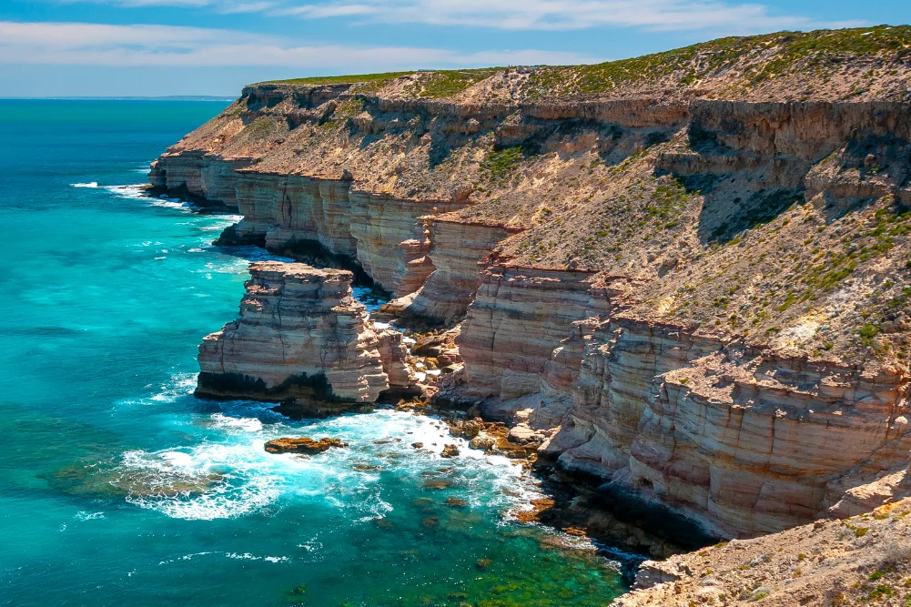
The departure from Western Australia’s capital along the fully sealed Indian Ocean Drive marks the beginning of a 500-plus-kilometre maritime journey north toward Kalbarri, tracing a landscape defined by dramatic limestone cliffs, shifting coastal dunes, and an explosion of post-winter seasonal flora. Spanning from Yanchep to Dongara before extending further north, this arterial route serves as the primary corridor for travelers exploring the state’s diverse coral coast, an ecosystem characterized by protected marine reserves, historical shipwreck trails, and ancient geological formations. Local tourism authorities note that the July-to-October window consistently draws peak visitor numbers due to the confluence of whale migrations, mild spring temperatures, and the state-wide botanical bloom, which features more than 12,000 distinct species of wildflowers.
Geological and Historical Context
The geographic profile of Western Australia’s coral coast has been shaped over millions of years through marine regression, wind erosion, and indigenous stewardship. Traditional owners, including the Yued people of the Noongar nation, have inhabited and managed these coastal strips for millennia, embedding deep historical narratives into natural landmarks such as the limestone Pinnacles and the coastal dunes of Wangaree—historically recognized as a rich fishing ground for western rock lobster.
European maritime history similarly permeates the coastline. During the 17th and 18th centuries, Dutch East India Company (VOC) vessels navigating the Roaring Forties frequently miscalculated their longitude, leading to numerous high-profile wrecks along the treacherous reefs. Maritime historians and marine archaeologists have documented at least 14 significant shipwrecks within the Lancelin island reef systems alone, alongside the famous loss of the Vergulde Draeck (Gilt Dragon) off Green Head in 1656. These maritime disasters have left a permanent cultural footprint, preserved today through specialized exhibits at the Geraldton Museum and memorial sites honoring subsequent tragedies, such as the World War II sinking of the HMAS Sydney II off the Mid West coast.
Chronological Exploration: South to North
The journey north unfolds across several distinct ecological zones, beginning at Lancelin, approximately 120 kilometres north of Perth. Famed for its extensive two-kilometre-long sand dunes on the town’s northern perimeter, the area operates as a multi-use hub for recreational sandboarding, kiteboarding, and commercial rock lobster harvesting. Conservation management plans overseen by the Department of Biodiversity, Conservation and Attractions (DBCA) carefully balance these high-impact recreational pursuits with the protection of the Lancelin Island Nature Reserve, an offshore sanctuary crucial for breeding seabirds and Australian sea lions.
Advancing northward into Nambung National Park, visitors encounter the Pinnacles Desert, an expanse of thousands of limestone pillars rising up to four meters from the yellow quartz sand of the Swan Coastal Plain. Geological studies indicate that these spires formed from ancient seashells in a time when the area was submerged beneath the sea; subsequent weathering dissolved the surrounding soft limestone while leaving the denser pillars exposed. Indigenous interpretation frames these structures within the Dreamtime, attributing their creation to the movements of Wagyl, the rainbow serpent.
Continuing past Cervantes, the coastal itinerary reaches Jurien Bay and Green Head. Jurien Bay supports an 800-strong breeding colony of Australian sea lions distributed across Buller Island, North Fisherman Island, and Essex Rocks. Due to strict conservation protocols governing these marine habitats, public access is restricted to regulated eco-tours. Marine biologists emphasize the ecological significance of the region’s extensive seagrass meadows, which act as vital nurseries for western rock lobsters and finfish species, contributing significantly to Western Australia’s commercial and recreational fisheries economy.
Inland deviations along the route introduce subterranean adventures, notably the Stockyard Gully Caves. Accessible via four-wheel-drive tracks off the Indian Ocean Drive between Leeman and Green Head, the 250-metre-long limestone tunnel system formed by ancient water flows provides a subterranean passage leading to a protected, lushly vegetated sinkhole. Conservationists highlight the fragility of these cave systems, noting that occasional heavy flooding scours the interior, leaving behind sparse stalactite formations that require careful environmental management to prevent degradation from rising tourism numbers.
Mid West Heritage and Marine Ecosystems
As the Indian Ocean Drive terminates at the Brand Highway, the journey enters the Mid West region, converging on Geraldton and Northampton. Agricultural landscapes dominate the Chapman Valley Scenic Drive, where extensive wheat fields intersect with localized biodiversity hotspots. Botanists categorize this region as a global biodiversity hotspot, with unique variants such as the ground-hugging wreath flower (Leschenaultia macrantha) and thousands of species of everlasting daisies thriving in the Mediterranean climate.
Further north, the Hutt Lagoon near Port Gregory presents a striking visual anomaly: a hyper-saline lake displaying vivid pink hues. Scientific analysis confirms that the coloration results from the presence of the carotenoid-producing microalgae Dunaliella salina. The concentration of beta-carotene fluctuates depending on solar intensity, cloud cover, and algal growth phases, making the lagoon both a significant commercial aquaculture site for natural food colorants and a major eco-tourism drawcard.
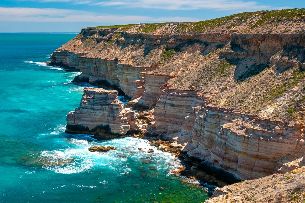
The northern terminus of the coastal corridor is anchored by Kalbarri National Park and the mouth of the Murchison River. The park features dramatic wave-cut sea cliffs at Eagle Gorge, the interior Murchison Gorge, and architectural engineering feats such as the Kalbarri Skywalk, which suspends visitors 100 meters above the riverbed. Marine ecologists monitor the adjacent Blue Holes Fish Habitat Protection Area, a sanctuary zone characterized by limestone reef platforms that support high densities of juvenile reef fish and coral species.
Economic and Tourism Implications
The continuous development and promotion of the Indian Ocean Drive and its connecting regional arteries are central to the Western Australian Government’s strategy for regional economic diversification. Tourism Western Australia reports that regional road trips contribute significantly to the state’s visitor economy, supporting small businesses ranging from boutique accommodations like Sols Place in Kalbarri and eco-camps near Jurien Bay, to indigenous-led tourism operations and heritage hospitality venues such as Finlays Kalbarri.
Infrastructure investments, including sealed road networks, marine jetty upgrades, and conservation boardwalks, have improved accessibility while simultaneously increasing the imperative for sustainable management. Environmental agencies continually assess visitor impacts on sensitive coastal dunes, nesting seabird colonies, and marine mammal habitats to ensure that the expansion of tourism does not compromise the ecological integrity of the coral coast.
Policy and Environmental Outlook
Looking forward, regional planners face the dual challenges of managing increased visitor volume and adapting to climate change pressures along the Western Australian coastline. Rising sea levels, changing precipitation patterns, and marine heatwaves pose recognized risks to delicate coral reef ecosystems, seagrass meadows, and terrestrial flora like the iconic wildflowers.
In response, local shires, state departments, and conservation groups are implementing targeted adaptive management frameworks. These include seasonal closures of sensitive breeding sites, community-led citizen science programs monitoring marine fauna populations, and strict guidelines for off-road vehicle use in dune environments. Through these coordinated regulatory measures, stakeholders aim to preserve the delicate equilibrium between industrial fishing, recreational accessibility, and pristine environmental conservation along one of Australia’s premier coastal drives.


 Diana Nuri Rohmawati

 Gabriela Annisa

 Lukman Taruna Persada Ramadan
 Tatiana Tantri Indah Sari
 Anjar Salim