 Walid Sujud Trenggono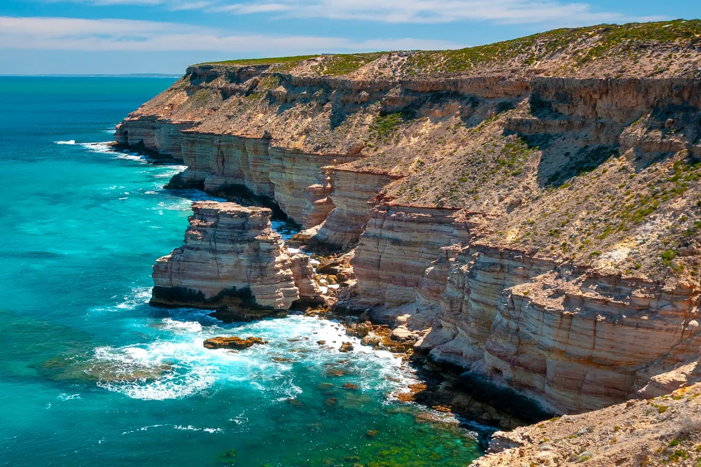
The Indian Ocean Drive, a 277-kilometre stretch of road connecting Lancelin to Dongara, has transformed the accessibility of Western Australia’s Mid West region since its full sealing and official opening in September 2010. This infrastructure project, which cost approximately $95 million, was designed to bypass the heavy haulage of the Brand Highway, offering tourists a more scenic coastal route and significantly boosting the regional economy. Stretching from the northern fringes of Perth to the rugged landscapes of Kalbarri, the route traverses a diverse array of ecosystems, from ancient limestone monoliths and mobile sand dunes to vibrant wildflower heaths and treacherous maritime heritage sites.
The Adventure Economy: Lancelin and the Sand Dune Ecosystem
The coastal town of Lancelin, located approximately 127 kilometres north of Perth, serves as the primary southern gateway for the Indian Ocean Drive. Known traditionally by its Yued Indigenous name, Wangaree, the town is a critical hub for the Western Rock Lobster (Panulirus cygnus) industry, which contributes hundreds of millions of dollars to the state’s economy annually. Beyond its commercial fishing significance, Lancelin has established itself as a premier destination for adventure tourism.
The Lancelin sand dunes, which represent the largest system of their kind in Western Australia, span approximately two kilometres and reach heights of up to 30 metres. These dunes are geologically active, constantly shifting under the influence of the "strong southerly" winds known locally as the Fremantle Doctor. This environmental feature has birthed a niche industry for sandboarding and off-road vehicle tours. Furthermore, the Lancelin Island Nature Reserve, situated 700 metres offshore, provides a sanctuary for the Australian sea lion and various migratory seabirds. The surrounding waters are a graveyard for maritime history, containing at least 14 known shipwrecks, which now serve as artificial reefs for recreational diving and snorkeling.
Geological Phenomena: The Pinnacles of Nambung National Park
Continuing north, the landscape transitions into the Swan Coastal Plain, home to the Nambung National Park and its world-renowned Pinnacles Desert. These thousands of weathered limestone pillars, some rising four metres high, are the remnants of an ancient era when the region was beneath the sea. Geologists suggest the structures were formed from the accumulation of seashells in a lime-rich sand, which were eventually exposed by wind erosion.
For the Yued people, the Pinnacles hold deep spiritual significance, often linked to the Wagyl, the Rainbow Serpent of Noongar dreaming. The site attracts over 650,000 visitors annually, making it one of the most visited natural attractions in Western Australia. The Department of Biodiversity, Conservation and Attractions (DBCA) manages the site, ensuring that the four-kilometre loop drive and various walking trails minimize human impact on the fragile limestone formations. Observations of native fauna, including Western Grey Kangaroos and Emus, are common during the dawn and dusk periods when the long shadows of the spires create a dramatic visual landscape.
Marine Conservation and the Jurien Bay Marine Park
The town of Jurien Bay represents a critical point for marine conservation and biodiversity. The Jurien Bay Marine Park, established in 2003, covers approximately 82,375 hectares and protects a unique temperate-tropical transition zone. The park is home to a significant population of the endangered Australian sea lion (Neophoca cinerea), one of the rarest seal species in the world.
Tour operators in Jurien Bay operate under strict environmental guidelines to provide interactive experiences with sea lion colonies at Buller Island and North Fisherman Island. Supporting data from the DBCA indicates that these colonies are vital for the species’ long-term survival, as they are among the few remaining breeding sites on the Western Australian coast. The marine park also supports a robust snorkeling and diving industry, centered on the Jurien Bay Snorkel Trail. This artificial reef, constructed near the old jetty, features over 70 concrete modules that have successfully recruited various species of coral, sponges, and finfish, providing an educational platform for marine ecology.
Historical Foundations and Inland Explorations: Green Head and Stockyard Gully
Further north, the hamlet of Green Head offers a blend of maritime history and subterranean exploration. Dynamite Bay, a semi-circular cove protected by rugged headlands, derives its name from 1960s treasure hunters who utilized explosives to search for the wreckage of the Vergulde Draeck (Gilt Dragon). The Dutch East India Company ship sank in 1656, and its discovery sparked decades of archaeological research and folklore regarding lost silver and survivors.
Inland from the coast lies the Stockyard Gully Reserve, accessible only by four-wheel-drive vehicles. The centerpiece of the reserve is a 250-metre-long limestone cave, carved by an ancient river system. Historically, the gully served as a natural stockyard for drovers moving cattle along the Old North Road between Perth and Geraldton. Today, the cave is a site of geological and botanical interest, featuring stalactites and providing a habitat for honey possums and various orchid species, including the rare Queen of Sheba.
Maritime Tragedy and Recovery: Geraldton’s Cultural Heritage
As the Indian Ocean Drive merges into the Brand Highway, the city of Geraldton emerges as the regional capital of the Mid West. Geraldton’s identity is inextricably linked to the sea, both as a major port and as a site of historical remembrance. The Museum of Geraldton houses significant artifacts from the Dutch shipwrecks of the 17th century, including the Batavia, whose sinking in 1629 led to a notorious episode of mutiny and murder.
A more contemporary site of historical significance is the HMAS Sydney II Memorial. Perched on Mount Scott, the memorial commemorates the 645 sailors lost in 1941 during a World War II battle with the German raider Kormoran. The location of the wreck remained a mystery for 66 years until its discovery in 2008. The memorial, featuring a dome of 645 stainless steel gulls, serves as a focal point for national remembrance and is a key driver for heritage tourism in the city.
The Botanical Goldmine: Western Australia’s Wildflower Season
The Mid West region is a central component of Western Australia’s wildflower phenomenon, which sees more than 12,000 species of flora bloom between July and October. This biological event is a significant economic driver, attracting international "botany tourists." The Chapman Valley Scenic Drive, located near Northampton, is famous for its carpets of everlasting daisies (Rhodanthe chlorocephala) and the elusive Wreath Flower (Lechenaultia macrantha).
The diversity of the flora is attributed to the region’s nutrient-poor soils and ancient landscape, which have forced plants to evolve unique survival mechanisms. Approximately 60% of these wildflower species are found nowhere else on Earth. Tourism Western Australia has historically utilized this "bloom" as a primary marketing tool, positioning the state as a global leader in nature-based tourism.
Biological Anomalies: The Salinity of Hutt Lagoon
Located near the town of Gregory, Hutt Lagoon is a salt lake famous for its pink hue, caused by the presence of the carotenoid-producing algae Dunaliella salina. This microalga is a source of beta-carotene, a food-coloring agent and source of Vitamin A. The lagoon contains the world’s largest microalgae production plant, a 250-hectare series of artificial ponds managed by BASF.
The color of the lagoon fluctuates based on salinity levels, temperature, and light intensity, ranging from deep burgundy to bubblegum pink. While the lake is a commercial industrial site, its aesthetic appeal has made it a global landmark for photography and social media, contributing to the "Instagrammable" tourism trend that has seen a surge in visitors to the Northampton Shire.
The Northern Frontier: Kalbarri and the Murchison River Gorge
The journey concludes in Kalbarri, where the Murchison River meets the Indian Ocean. Kalbarri National Park, covering 186,000 hectares, underwent a major infrastructure upgrade in 2020 with the opening of two cantilevered skywalks. The $20 million project, funded by the State Government, allows visitors to stand 100 metres above the Murchison River Gorge, providing views of the 400-million-year-old Tumblagooda Sandstone.
Kalbarri’s coastline is defined by dramatic cliffs such as Eagle Gorge and the Natural Bridge, sculpted by the relentless power of the Southern Indian Ocean. The region is also a National Surfing Reserve, with "Jakes Point" recognized globally for its powerful left-hand break. The town’s economy, while heavily reliant on tourism, also maintains a strong connection to the fishing industry, particularly for species like mulloway and snapper.
Analysis of Implications and Future Outlook
The development of the Indian Ocean Drive and the subsequent promotion of the Coral Coast have had profound implications for regional Western Australia. Economically, the route has decentralized tourism from the Perth metropolitan area, spreading revenue into small coastal hamlets. However, this growth brings challenges regarding environmental sustainability and infrastructure maintenance.
Increased foot traffic in sensitive areas like Nambung National Park and the Kalbarri Skywalk necessitates ongoing investment in conservation management to prevent the degradation of ancient geological sites. Furthermore, the region is on the front lines of climate change; shifts in rainfall patterns could impact the reliability of the wildflower season, while rising sea temperatures pose a threat to the kelp forests and rock lobster habitats that underpin the local economy.
Governmental bodies, including Tourism WA and the various regional shires, continue to balance the need for economic expansion with the preservation of the "wild" character that defines the Indian Ocean adventure. As the state looks to diversify its economy away from a heavy reliance on mining, the sustainable management of these natural assets remains a high-priority strategic objective. The Indian Ocean Drive is no longer just a road; it is a critical corridor for the state’s cultural, historical, and environmental identity.




 Anjar Salim
 Chandra Hamzah
 Tatiana Tantri Indah Sari
 Budi Mulyono
 Lukman Taruna Persada Ramadan