The Mary River National Park, situated approximately 150 kilometers east of Darwin, stands as one of the Northern Territory’s most ecologically significant and recreationally diverse protected areas. Spanning vast floodplains, monsoon forests, and tidal river systems, the park is globally recognized for harboring the highest concentration of estuarine (saltwater) crocodiles on Earth. As a critical sanctuary for biodiversity and a premier destination for recreational angling, the Mary River Wetlands represent a complex intersection of environmental conservation, historical heritage, and regional tourism.
Geographic and Ecological Overview
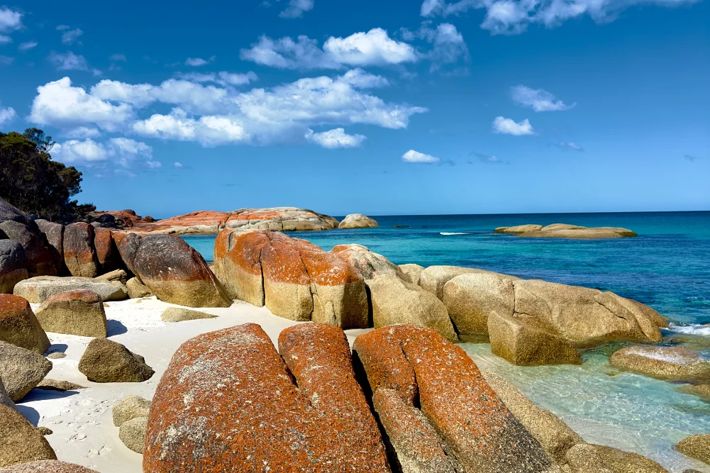
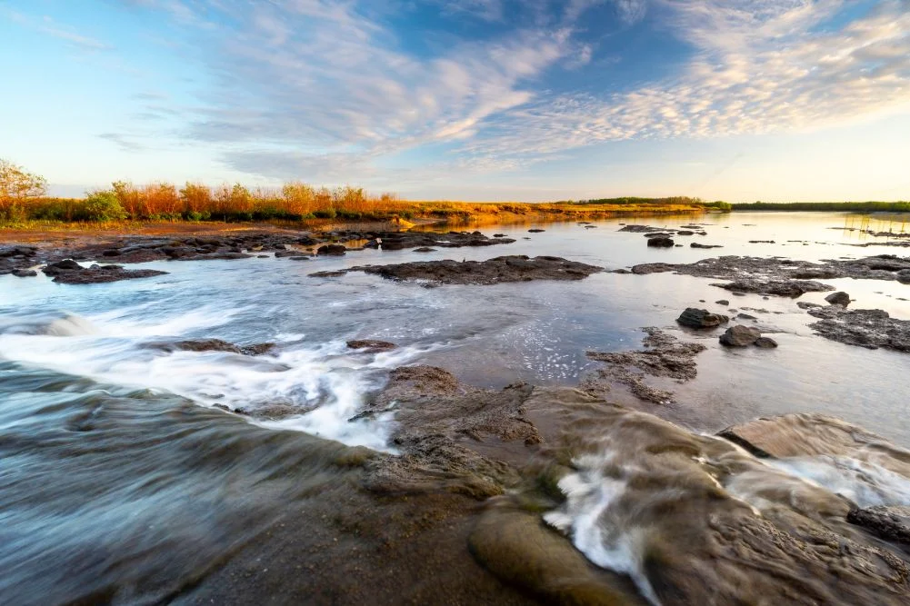
The Mary River catchment covers an area of approximately 8,000 square kilometers. Unlike many other river systems in the Top End, the Mary River does not have a single major mouth opening into the sea. Instead, it diffuses into a vast network of multi-channelled wetlands before reaching the Arafura Sea. This unique geography creates a mosaic of habitats, including lily-fringed lagoons, verdant floodplains, dense monsoon vine forests, and mangrove-lined tidal reaches.
The region is characterized by extreme seasonal shifts. During the wet season (October to April), monsoonal rains inundate the plains, creating an expansive inland sea. As the dry season progresses (May to September), the waters recede into permanent billabongs and river channels, concentrating wildlife in accessible pockets. This seasonal "run-off" is a pivotal event for the local ecosystem and the regional economy, as it triggers the movement of barramundi from the wetlands into the river systems, attracting thousands of anglers annually.
Historical Context: The Legacy of John McDouall Stuart
The human history of the Mary River is deeply intertwined with the exploration of the Australian interior. Shady Camp, a focal point of the park, derives its name from the journals of John McDouall Stuart. In 1862, Stuart led the first successful European expedition to cross the Australian continent from south to north, traveling from Port Augusta to the Timor Sea.
On July 24, 1862, Stuart and his party reached the Mary River wetlands, marking the final stages of a grueling 3,540-kilometer journey. Stuart’s successful navigation of the "mysterious interior" paved the way for the Australian Overland Telegraph Line and subsequent pastoral development. Today, the Stuart’s Tree Memorial Cairn, located near Point Stuart, serves as a historical marker of this feat. Access to this site remains dependent on seasonal conditions, typically requiring high-clearance four-wheel-drive vehicles once the floodwaters of the wet season have subsided.
Environmental Management and the Shady Camp Barrage
In the late 1980s, the Mary River system faced a significant ecological threat from saltwater intrusion. Rising sea levels and the breakdown of natural levees—exacerbated by the grazing of feral water buffalo—allowed saltwater to penetrate deep into freshwater wetlands, destroying large swathes of paperbark forests and freshwater habitats.
In response, authorities constructed a concrete barrage at Shady Camp. This artificial barrier was designed to inhibit the upstream flow of saltwater during high tides, thereby preserving the freshwater integrity of the upstream lagoons. While the barrage has been largely successful in maintaining the freshwater ecosystem, it has created a unique "bottleneck" effect. During the run-off, freshwater fish, including barramundi and mullet, are swept over the barrage or attempt to leap over it to reach upstream nurseries. This phenomenon creates a high-activity feeding zone for apex predators, most notably the estuarine crocodile and various raptors.
Wildlife Profile: Apex Predators and Avian Biodiversity
The Mary River is synonymous with Crocodylus porosus, the saltwater crocodile. Population surveys conducted by the Parks and Wildlife Commission of the Northern Territory indicate that the river system supports an exceptionally high biomass of these reptiles. The abundance of food sources in the wetlands allows crocodiles to reach significant sizes, with some males exceeding five meters in length.
Beyond crocodiles, the wetlands are an internationally recognized birdwatching destination. The park serves as a vital breeding ground for several species:
- Comb-crested Jacana (Irediparra gallinacea): Known colloquially as "Jesus birds" due to their ability to walk on floating lily pads using elongated toes.
- Magpie Geese (Anseranas semipalmata): Large flocks congregate on the floodplains to feed on water chestnut tubers.
- Jabiru (Black-necked Stork): Australia’s only stork species, often seen foraging in the shallow fringes of billabongs.
- Raptors: The region supports high densities of white-bellied sea eagles and whistling kites, which capitalize on the seasonal fish concentrations.
The terrestrial fringes of the wetlands are inhabited by agile wallabies, monitor lizards (goannas), and a variety of snake species, while the monsoon forests provide refuge for orange-footed scrub fowls and rainbow bee-eaters.
Infrastructure and Recreational Access
The Northern Territory government maintains several key sites within the park to facilitate tourism and conservation.
Shady Camp
Shady Camp serves as a primary hub for both camping and boat launching. It features a dual-access boat ramp providing entry to both the freshwater reaches upstream and the tidal saltwater reaches downstream. The site is equipped with rustic camping facilities, including fire pits and toilets. Due to the high crocodile density, swimming is strictly prohibited, and anglers are advised to maintain a safe distance from the water’s edge.
Couzens Lookout
Located on the banks of the Mary River, Couzens Lookout offers a more elevated perspective of the wetlands. The area is noted for its spectacular sunset views and serves as a quieter alternative to the high-traffic fishing zones. It provides access to Rockhole Billabong, a 30-kilometer maze of freshwater channels.
Point Stuart Wilderness Lodge
For visitors seeking more structured amenities, the Point Stuart Wilderness Lodge offers lodge-style accommodation, safari tents, and a restaurant. The lodge plays a critical role in the local tourism economy, offering guided fishing safaris and wetland cruises that provide safe, interpreted access to the complex river systems.
Regional Economic Impact of Recreational Fishing
Recreational fishing is a cornerstone of the Northern Territory’s economy, and the Mary River is one of its most productive assets. The pursuit of barramundi (Lates calcarifer) drives significant expenditure in the region. According to economic data from the NT Department of Industry, Tourism and Trade, recreational fishing contributes over $270 million annually to the Territory’s economy.
The Mary River is particularly prized for "metery" barramundi—fish exceeding one meter in length. The Shady Camp area becomes a focal point for this activity during the "run-off" (March to May) and the "build-up" (October to December). The availability of boat hire services and guided tours ensures that the economic benefits of the wetlands are distributed across local service providers.
Environmental Challenges and Future Implications
Despite its protected status, the Mary River National Park faces ongoing management challenges. Invasive flora, such as Mimosa pigra and salvinias, threaten to choke waterways and displace native vegetation. Additionally, the management of feral animals, including pigs and buffalo, remains a priority to prevent soil erosion and levee damage.
Climate change presents a long-term threat to the wetlands. As a low-lying coastal system, the Mary River is highly vulnerable to sea-level rise. Increased saltwater inundation could potentially overwhelm the existing barrage system, leading to a permanent shift in the ecosystem from freshwater to saline. Conservationists and government bodies continue to monitor these variables to develop adaptive management strategies that will preserve the wetlands for future generations.
Practical Information for Visitors
The Mary River National Park is accessible via the Arnhem Highway. Visitors are encouraged to plan trips according to the seasonal cycle:
- Dry Season (May–September): Ideal for general tourism, birdwatching, and camping. Roads are generally accessible to conventional vehicles.
- Wet Season (October–April): High risk of flooding and road closures. Many areas, including Shady Camp, may become inaccessible.
- Safety: The "Crocwise" protocol is essential. Visitors must assume crocodiles are present in any body of water and should never camp within 50 meters of a water source.
- Permits: Entry to Northern Territory national parks requires a park pass, which can be purchased online. Revenue from these passes is reinvested into the maintenance and conservation of the park infrastructure.
The Mary River Wetlands remain a testament to the raw, prehistoric beauty of the Australian Top End. Through a combination of historical reverence, strict environmental management, and sustainable tourism, the region continues to thrive as a premier wilderness sanctuary.