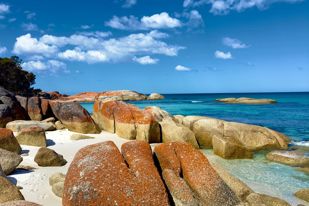
The Mary River Wetlands, situated approximately 150 kilometers east of Darwin, represent one of the most ecologically significant and biodiverse regions in Australia’s Northern Territory. Encompassing a vast expanse of lily-fringed lagoons, verdant floodplains, dense monsoon forests, and tidal reaches, the region serves as a critical sanctuary for a diverse array of flora and fauna. Most notably, the Mary River system is recognized for harboring the highest concentration of estuarine (saltwater) crocodiles in the world, making it a focal point for ecological research, recreational fishing, and wilderness tourism.
Geographical and Ecological Overview
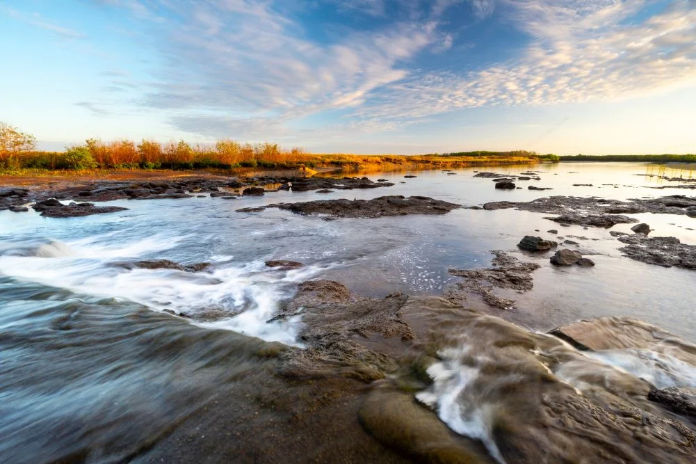
The Mary River catchment covers an area of approximately 8,000 square kilometers. Unlike many other river systems in the Top End, the Mary River does not have a single major mouth discharging into the sea; instead, it dissipates into a complex network of wetlands before eventually reaching the Arafura Sea. This unique hydrological structure has created a mosaic of habitats, ranging from freshwater billabongs to saline mudflats.
The biodiversity of the wetlands is a primary draw for both scientists and tourists. The region supports over 250 species of birds, including the iconic Jabiru (black-necked stork), Magpie Geese, and the Comb-crested Jacana, colloquially known as the "Jesus bird" for its ability to walk on floating vegetation. The waterways are also home to the barramundi, a premier game fish that drives a significant portion of the local tourism economy.
However, the defining feature of the Mary River is the Crocodylus porosus, or estuarine crocodile. Following the cessation of unregulated hunting in the early 1970s, crocodile populations in the Northern Territory have recovered significantly. In the Mary River, the density of these apex predators is estimated to be significantly higher than the regional average, necessitating stringent safety protocols for all visitors.
Historical Context and Exploration
The human history of the Mary River Wetlands is a tapestry of ancient Indigenous stewardship and mid-19th-century European exploration. The area is the traditional country of several Aboriginal groups, including the Wulna and Limilngan people, who have maintained a spiritual and physical connection to the land for tens of thousands of years.
In the colonial era, the region gained prominence during the mid-1800s. The site now known as Shady Camp was named by the explorer John McDouall Stuart in 1862. Stuart, leading his sixth expedition, was attempting to find a viable overland route from Adelaide to the northern coast of Australia. His success in traversing the continent’s "mysterious interior" was a pivotal moment in Australian history, facilitating the construction of the Australian Overland Telegraph Line and opening the North to pastoralism and further development.
Stuart’s journals indicate that Shady Camp served as a vital resting point near the end of his 3,540-kilometer journey. After recuperating on the banks of the Mary River, Stuart finally reached the northern coastline at Chambers Bay, effectively completing the first south-to-north crossing of the continent. Today, the Stuart’s Tree Memorial Cairn at Point Stuart stands as a historical monument to this feat, though access remains highly dependent on seasonal weather conditions.
The Shady Camp Barrage and Environmental Management
One of the most significant anthropogenic interventions in the Mary River Wetlands is the Shady Camp barrage. Constructed in the late 1980s, this concrete structure was designed as a salt-exclusion bund. Its primary purpose is to prevent the inland intrusion of saltwater from the tidal reaches of the river into the freshwater floodplains.
Saltwater intrusion became a critical environmental threat in the mid-20th century, largely exacerbated by the impact of feral water buffalo. These heavy animals created "swim-ways" through the wetlands, which breached natural levees and allowed tidal salt water to flow into freshwater lagoons, killing off vast tracts of melaleuca (paperbark) forests and destroying habitats for freshwater species.
While the barrage has been successful in stabilizing certain freshwater habitats, it has also created a unique ecological "choke point." During the "run-off"—the period at the end of the wet season when floodwaters recede—water flows over the barrage toward the sea. This flow carries a high concentration of baitfish and nutrients, attracting both anglers and crocodiles. The spectacle of barramundi leaping over the barrage and crocodiles waiting downstream to intercept them has become a hallmark of the Shady Camp experience.
The "Run-Off" and the Barramundi Economy
Recreational fishing is a cornerstone of the Northern Territory’s economy, contributing an estimated $270 million annually to the regional GDP. The Mary River is arguably the most famous destination for barramundi fishing in Australia.
The "run-off" season, typically occurring between March and May, represents the peak period for angling. As the floodwaters from the Arnhem Land escarpment and the surrounding plains drain into the Mary River, they carry immense volumes of organic matter. This biological "flush" triggers a feeding frenzy among barramundi, which congregate near the barrage and in the tidal creeks.
The management of this resource is a delicate balance. The Northern Territory Government employs strict bag limits and size restrictions to ensure the sustainability of the barramundi population. Furthermore, the presence of saltwater crocodiles adds a layer of risk management that is unique to Northern Australian angling. Authorities consistently issue "CrocWise" warnings, advising fishers to stay at least five meters back from the water’s edge and to avoid cleaning fish near boat ramps.
Wildlife and Avian Biodiversity
For non-anglers, the Mary River National Park offers some of the most accessible wildlife viewing in the Top End. The park’s birdlife is particularly prolific during the dry season (May to September), when receding water levels concentrate birds around permanent billabongs like Mistake Billabong and Rockhole.
The avian population is characterized by its diversity:
- Waterbirds: Large flocks of Magpie Geese and Whistling Ducks dominate the skies, while Egrets and Herons stalk the shallows.
- Raptors: White-bellied Sea Eagles and Whistling Kites are frequently observed nesting in the tall riparian forests.
- Specialized Species: The Rainbow Bee-eater and various species of Kingfisher provide vibrant displays of color, while the Nankeen Night Heron is often spotted during the crepuscular hours.
Terrestrial wildlife is also abundant. Agile wallabies are common along the grassy verges of the wetlands, and monitors (large lizards) are frequently seen foraging along the banks. The monsoon forests, such as those found along the Jimmy Creek and Brian Creek walks, provide a cooler microclimate that supports orange-footed scrub fowls and various species of fruit bats.
Tourism Infrastructure and Accessibility
The Northern Territory Government has invested in infrastructure to make the Mary River National Park accessible to a broad range of visitors while maintaining its primitive appeal.
Camping and Accommodation:
The park offers several tiers of accommodation. Shady Camp and Couzens Lookout provide rugged camping experiences with basic amenities such as fire pits and toilets. For visitors seeking higher levels of comfort, the Point Stuart Wilderness Lodge offers lodge rooms, safari tents, and a swimming pool.
Navigation and Exploration:
Boat ramps at Shady Camp, Corroboree Billabong, and the Rockhole allow private vessel owners to explore the intricate channel systems. For those without boats, several commercial operators provide guided cruises. These tours are essential for visitors wanting to safely observe the larger estuarine crocodiles and the dense bird colonies that are inaccessible by land.
Seasonal Constraints:
Accessibility is the primary challenge for Mary River tourism. The "Wet Season" (October to April) often leads to extensive flooding, which can close roads and submerge campgrounds. Conversely, the "Dry Season" offers stable temperatures (ranging from 20°C to 31°C) and clear skies, making it the primary window for visitation.
Analysis of Implications and Conservation Challenges
The future of the Mary River Wetlands faces several critical challenges. Climate change poses a significant threat, as rising sea levels could potentially overwhelm the existing salt-exclusion barrages, leading to another era of widespread saltwater intrusion and habitat loss.
Furthermore, the management of invasive species remains an ongoing struggle. While the feral buffalo population has been reduced from its mid-20th-century peaks, invasive weeds such as Mimosa pigra and Salvinia molesta continue to threaten the ecological integrity of the floodplains. These weeds can choke waterways, outcompete native vegetation, and reduce the habitat available for fish and birds.
The Northern Territory Parks and Wildlife Commission continues to implement integrated management strategies, combining controlled burns, weed eradication programs, and crocodile population monitoring. The goal is to preserve the "wild" character of the Mary River while supporting a sustainable tourism industry that educates the public on the importance of wetland conservation.
Conclusion
The Mary River Wetlands stand as a testament to the raw, prehistoric beauty of Australia’s Top End. From the historical echoes of John McDouall Stuart’s expedition to the modern-day thrill of barramundi fishing amidst apex predators, the region offers a unique intersection of history, ecology, and adventure. As management practices evolve to meet the challenges of climate change and invasive species, the Mary River remains a vital ecological corridor and a premier destination for those seeking to experience the unrefined wilderness of the Northern Territory. Visitors are reminded that while the wetlands are a place of immense beauty, they are also a primitive environment where nature’s laws remain paramount. Careful planning, respect for the environment, and adherence to safety guidelines ensure that this "secret" of the Top End remains preserved for future generations.