 Walid Sujud Trenggono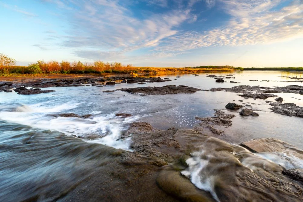
The Mary River Wetlands, situated approximately 150 kilometers east of Darwin in Australia’s Northern Territory, represent one of the most significant ecological and recreational landscapes in the Top End. Known for harboring the highest concentration of estuarine (saltwater) crocodiles in the world, the region serves as a vital sanctuary for biodiversity and a premier destination for eco-tourism and recreational fishing. Spanning a diverse array of environments—including lily-fringed lagoons, vast floodplains, monsoon forests, and tidal reaches—the Mary River National Park offers a complex ecosystem that transitions dramatically between the tropical wet and dry seasons. This report provides an in-depth analysis of the region’s geographical significance, its historical context, and the management of its natural resources.
Ecological Profile and Biodiversity Data
The Mary River system is unique among Northern Territory waterways because it lacks a single, well-defined mouth where it meets the sea. Instead, it fans out into a multi-channel delta, creating a sprawling network of wetlands that cover over 1,000 square kilometers. This geographical quirk facilitates a high level of nutrient retention, which in turn supports a staggering density of wildlife.
Data from the Northern Territory Department of Environment, Parks and Water Security indicates that the Mary River catchment is a critical breeding ground for several species. The estuarine crocodile (Crocodylus porosus) population in the Mary River is estimated to be among the densest globally, with some surveys indicating upwards of five to ten crocodiles per kilometer in certain stretches. This density is a direct result of the abundant food sources provided by the annual "run-off," where receding floodwaters transport fish from the floodplains back into the main river channels.
The avian population is equally significant. The wetlands serve as a major stopover for migratory birds and a permanent home for roughly 250 species. Key species include the Magpie Goose (Anseranas semipalmata), which gathers in flocks numbering in the tens of thousands during the dry season, and the Jabiru (Ephippiorhynchus asiaticus), Australia’s only stork. The presence of "Jesus birds," or Comb-crested Jacanas, which utilize their long toes to walk across floating lily pads, underscores the specialized adaptations found within this habitat.
Historical Chronology: From Exploration to Conservation
The human history of the Mary River region is defined by a transition from arduous exploration to intensive conservation management.
- Indigenous Heritage: For millennia, the Limilngan and Wulna people have served as the traditional custodians of the Mary River region. Their knowledge of the seasonal cycles and wildlife behavior remains integral to the cultural landscape of the area.
- 1862 – The Stuart Expedition: John McDouall Stuart, one of Australia’s most famous explorers, reached the Mary River during his sixth and final expedition. After traversing 3,540 kilometers from Port Augusta in South Australia, Stuart and his party rested at a location now known as Shady Camp. On July 24, 1862, they reached the Arafura Sea at Chambers Bay, marking the first successful European crossing of the Australian continent from south to north.
- Late 19th and Early 20th Century: The area saw various attempts at pastoralism and buffalo hunting. Introduced water buffalo caused significant environmental degradation, trampling wetlands and creating "swim-ways" that allowed saltwater to penetrate deep into freshwater systems.
- 1980s – Environmental Intervention: By the 1980s, saltwater intrusion threatened to destroy the freshwater paperbark forests and lagoons. In response, a concrete barrage was constructed at Shady Camp to prevent tidal saltwater from moving upstream, effectively bifurcating the river into saltwater and freshwater zones.
- Present Day: The region is now managed as a National Park, with a focus on balancing recreational use—particularly barramundi fishing—with the preservation of its fragile wetlands.
The Shady Camp Barrage: A Focal Point of Conflict and Opportunity
The Shady Camp barrage is perhaps the most scrutinized piece of infrastructure in the Mary River National Park. While its primary purpose is ecological—acting as a dam to protect freshwater habitats—it has become a legendary site for recreational anglers. During the "run-off" (typically March to May), the barrage becomes a site of intense biological activity. As freshwater pours over the concrete wall toward the sea, it carries with it baitfish and larger species like barramundi (Lates calcarifer).
This concentration of biomass attracts three primary groups: anglers, crocodiles, and avian predators. The phenomenon creates a high-stakes environment where humans and apex predators operate in close proximity. Fishermen often stand on or near the barrage to cast lines, while large estuarine crocodiles congregate below to intercept fish. Management authorities have frequently issued warnings regarding this behavior, noting that the "human-wildlife interface" at Shady Camp is one of the most high-risk areas in the Northern Territory.
In addition to crocodiles, the barrage facilitates a unique viewing of Mullet migration. These fish are often observed attempting to jump the concrete barrier to reach the freshwater pools upstream, providing a consistent food source for White-bellied Sea Eagles and various species of herons and cormorants.
Tourism Infrastructure and Economic Impact
The Mary River Wetlands are a vital component of the Northern Territory’s tourism economy, which contributes significantly to the region’s Gross State Product. The accessibility of the park—located just a two-hour drive from Darwin—makes it a primary destination for both domestic and international visitors.
Accommodation and Access
The park offers a tiered approach to tourism infrastructure:
- Commercial Lodging: Establishments like the Point Stuart Wilderness Lodge provide high-end amenities, including safari tents and lodge rooms. These facilities often serve as hubs for guided tours, which are essential for visitors who do not possess their own watercraft.
- Public Campgrounds: Managed by the NT Government, sites at Shady Camp and Couzens Lookout provide essential facilities such as fire pits and toilets. These sites are designed to offer a "wilderness experience" while maintaining safety standards.
- Navigational Infrastructure: Multiple boat ramps (at Shady Camp, the Rockhole, and Corroboree Billabong) allow private boat owners to access the labyrinthine waterways. The use of "Polycraft" vessels and airboats has become common for navigating the shallow, weed-choked sections of the wetlands.
Guided Operations
Commercial operators such as Corroboree Billabong Wetland Cruises and Wildlands provide educational tours that focus on wildlife spotting and ecological interpretation. These operations are subject to strict environmental regulations to ensure that the presence of tourists does not disrupt the nesting patterns of birds or the basking behavior of crocodiles.
Conservation Challenges and Future Implications
Despite its status as a protected area, the Mary River Wetlands face ongoing environmental challenges. The primary concern for conservationists is the management of invasive species. While the buffalo population has been largely controlled, invasive weeds such as Mimosa (Mimosa pigra) and Salvinia (Salvinia molesta) pose a constant threat to the native flora. These plants can quickly choke waterways, reducing oxygen levels in the water and displacing native vegetation like the iconic pink lotus lily.
Furthermore, climate change presents a long-term threat to the barrage system. Rising sea levels could eventually overtop the current infrastructure, leading to a renewed crisis of saltwater intrusion. Scientists and park managers are currently evaluating long-term strategies to reinforce these barriers or allow for a managed transition of the ecosystem.
The economic implications of these environmental factors are significant. The barramundi fishing industry in the Northern Territory is valued at millions of dollars annually. Any decline in the health of the Mary River system would have a direct impact on the livelihoods of charter operators and the broader hospitality sector in Darwin and the Adelaide River region.
Safety and Seasonal Planning for Visitors
For those planning to visit the Mary River Wetlands, adherence to seasonal constraints is mandatory. The region operates on a binary weather system:
- The Dry Season (May to September): This is the peak period for tourism. Humidity is lower, temperatures are manageable (ranging from 20°C to 31°C), and most roads are accessible to two-wheel-drive vehicles. The mosquito population, while still present, is significantly reduced compared to the wetter months.
- The Wet Season (October to April): Heavy monsoonal rains frequently lead to the closure of unsealed roads, including the access path to Shady Camp. During this time, the floodplains are replenished, and much of the park becomes inaccessible except by air or specialized watercraft.
Safety remains the paramount concern for all visitors. The Northern Territory government maintains a "CrocWise" program, emphasizing that any body of water in the Top End should be assumed to contain crocodiles. Activities such as cleaning fish at the water’s edge or standing in shallow water are strictly discouraged.
In conclusion, the Mary River Wetlands represent a delicate balance between a high-production biological engine and a premier recreational asset. Its management requires a sophisticated understanding of hydrology, wildlife biology, and human behavior. As the Northern Territory continues to develop its eco-tourism sector, the Mary River will undoubtedly remain a cornerstone of the region’s identity, offering a raw and unvarnished look at the power of the Australian tropics.



 Anjar Salim
 Chandra Hamzah
 Tatiana Tantri Indah Sari
 Budi Mulyono
 Lukman Taruna Persada Ramadan