 Walid Sujud Trenggono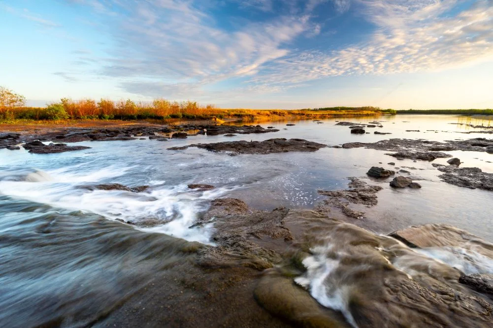
Located approximately 150 kilometers east of Darwin, the Mary River National Park represents one of the most ecologically diverse and predator-dense environments in Australia’s Top End. Spanning a vast landscape of lily-fringed lagoons, verdant floodplains, and dense monsoon forests, the Mary River catchment covers roughly 8,000 square kilometers. It serves as a critical sanctuary for a high concentration of estuarine (saltwater) crocodiles, making it a focal point for ecological research, recreational fishing, and nature-based tourism. While the region is often overshadowed by the larger Kakadu National Park to the east, the Mary River Wetlands offer a more concentrated experience of the Northern Territory’s unique biodiversity, characterized by its seasonal transformations and rugged accessibility.
Ecological Significance and Predator Density
The Mary River is internationally recognized for its extraordinary population of Crocodylus porosus, the estuarine crocodile. Following the federal ban on commercial crocodile hunting in 1971, populations across the Northern Territory have rebounded from near-extinction to an estimated 100,000 adults in the wild. The Mary River system, in particular, is noted for having the highest density of these apex predators globally. In some surveyed sections of the river, researchers have recorded as many as five to ten crocodiles per kilometer.
This high density is attributed to the rich nutrient flow from the surrounding floodplains, which supports a robust food chain. The wetlands also provide essential nesting habitats for several bird species and serve as a nursery for various fish, including the iconic barramundi (Lates calcarifer). The interplay between the saltwater tidal reaches and the freshwater upstream lagoons creates a complex brackish environment that sustains both marine and freshwater species, contributing to the park’s status as a premier destination for wildlife observers and anglers alike.
Historical Context and Exploration Chronology
The human history of the Mary River region is deeply intertwined with both Indigenous heritage and the era of European exploration. For thousands of years, the Limilngan and Wulna people have served as the traditional custodians of this land, managing the resources of the wetlands through seasonal cycles.
In the mid-19th century, the region became a focal point for transcontinental exploration. The chronology of modern exploration in the area is defined by the following key events:
- July 1862: Explorer John McDouall Stuart reached the Mary River during his sixth and final expedition. This journey marked the first successful European crossing of the Australian continent from south to north, originating in Adelaide. Stuart rested his party at a location now known as Shady Camp before pushing through to the Arafura Sea at Chambers Bay.
- Late 1800s: The region saw the introduction of water buffalo from Southeast Asia, which subsequently went feral and caused significant environmental degradation to the wetland’s delicate flora.
- 1980s: Environmental management became a priority. In the late 1980s, the Shady Camp barrage was constructed. This skinny concrete dam was designed to prevent saltwater intrusion into the freshwater upstream reaches, a phenomenon exacerbated by the tidal channels carved out by feral buffalo.
- 2000s to Present: The expansion of the Mary River National Park has formalized the protection of these lands, shifting the regional economy from buffalo culling and pastoralism toward sustainable tourism and conservation.
The Shady Camp Barrage and the "Run-Off" Phenomenon
A central feature of the park’s infrastructure is the Shady Camp barrage, which serves as a literal and figurative divide between two ecosystems. During the "run-off"—the period at the end of the wet season (typically March and April) when floodwaters recede from the plains back into the river channels—the barrage becomes a site of intense biological activity.
As water plunges over the concrete barrier, it carries a wealth of nutrients and small fish, triggering a feeding frenzy among larger predators. This period is the most significant in the regional calendar for recreational anglers. The competition for barramundi is fierce, not only among humans but also among the estuarine crocodiles that congregate below the barrage. Observations of crocodiles leaping or positioning themselves in the rapid flow to catch fish are common, highlighting the adaptive hunting strategies of the species.
Despite the obvious dangers, the barrage remains a popular, albeit treacherous, spot for land-based fishing. The presence of both saltwater crocodiles and aggressive bull sharks in these tidal reaches necessitates extreme caution, with authorities frequently issuing warnings regarding the risks of standing near the water’s edge.
Avian Biodiversity: An Auditorium of the Wild
Beyond its reptilian inhabitants, the Mary River Wetlands are a critical habitat for migratory and resident birdlife. The park is home to a significant portion of the Northern Territory’s bird species, particularly during the dry season when water sources elsewhere begin to vanish.
Key species frequently sighted include:
- Comb-crested Jacana: Known colloquially as "Jesus birds" for their ability to walk on floating lily pads using their elongated toes.
- Magpie Geese: These birds congregate in the thousands, their honking calls defining the acoustic landscape of the floodplains.
- Jabiru (Black-necked Stork): Australia’s only stork species, often seen foraging in the shallows for fish and amphibians.
- Nankeen Night Heron: A nocturnal hunter that can be spotted in the low-light hours of dawn and dusk.
The "auditorium" of the wetlands also includes rainbow bee-eaters, various species of cockatoos, and the sea eagle, which acts as a secondary apex predator, competing with crocodiles for surface-feeding fish.
Terrestrial Exploration: Monsoon Forests and Billabongs
The park’s terrestrial landscape is characterized by its diversity, ranging from sun-drenched plains to the cool, shaded environments of monsoon forests. Several walking trails provide access to these distinct biomes:
- Jimmy Creek Monsoon Forest Walk: This 1.6km loop winds through a dense canopy of giant banyan trees and verdant palms. The forest floor is often dominated by the nesting mounds of orange-footed scrub fowls, which can reach heights of several meters.
- Brian Creek Monsoon Forest Walk: A 2km trail that offers a similar immersion into the rainforest-like pockets of the Top End, providing a habitat for agile wallabies and various reptiles.
- Mistake Billabong: A permanent waterbody that serves as a vital refuge for wildlife during the peak of the dry season. A dedicated viewing shelter allows visitors to observe floodplain monitors and waterbirds without disturbing the ecosystem.
- Couzens Lookout: Situated on the edge of a billabong, this site offers elevated views of the wetlands. It is particularly noted for its sunset vistas, when the changing light highlights the vibrant colors of the lilies and the surrounding escarpment.
Economic Impact and Regional Tourism
Tourism in the Mary River region is a significant contributor to the Northern Territory’s economy. The "Nature and Wildlife" sector is a primary driver for visitation to the Top End, with recreational fishing alone contributing over $270 million annually to the NT’s Gross State Product.
The Mary River serves as a more accessible alternative to the remote reaches of Arnhem Land. Its proximity to Darwin—a two-hour drive—makes it a viable destination for day-trippers and short-stay campers. This accessibility supports a network of local businesses, including the Point Stuart Wilderness Lodge and various charter boat operators. These enterprises provide essential infrastructure, from guided fishing safaris to eco-cruises on Corroboree Billabong, which allow visitors to view the wetlands from the safety of specialized vessels.
However, the industry faces challenges related to seasonal variability. The park is highly susceptible to flooding, which can close access roads from October through April. Consequently, the regional economy is highly cyclical, relying heavily on the five-month window of the dry season.
Infrastructure and Visitor Logistics
Management of the park falls under the jurisdiction of the Parks and Wildlife Commission of the Northern Territory. To maintain the integrity of the environment while accommodating visitors, the commission has established several managed sites:
- Camping: Major campgrounds at Shady Camp and Couzens Lookout provide basic amenities such as fire pits and toilets. Due to the high density of predators, camping is strictly regulated to designated areas away from the water’s edge.
- Boating: Boat ramps are strategically located at Corroboree Billabong, Shady Camp, and the Rockhole. These facilities are essential for both recreational anglers and commercial tour operators.
- Environmental Protection: The commission implements strict "Crocwise" safety protocols. Statistical data indicates that while crocodile attacks are rare, they are almost always the result of human proximity to the water in known crocodile habitats.
Broader Implications and Conservation Outlook
The future of the Mary River Wetlands is closely tied to the broader challenges of climate change and invasive species management. Sea-level rise poses a significant threat to the freshwater components of the wetlands; even a minor increase in sea level could breach existing barrages, leading to widespread saltwater intrusion and the loss of freshwater lily lagoons.
Furthermore, the management of invasive flora, such as mimosa (Mimosa pigra) and salvinias, remains a constant struggle for park rangers. These weeds can choke waterways, depleting oxygen levels and displacing native species.
In conclusion, the Mary River National Park stands as a testament to the resilience of the Northern Territory’s wild ecosystems. It is a region where historical exploration meets modern conservation, and where the balance between human recreation and the preservation of apex predators is constantly navigated. For the scientific community, it remains a living laboratory for reptilian behavior and wetland ecology; for the public, it is a formidable and pristine window into Australia’s ancient natural heritage. Success in the coming decades will depend on maintaining the delicate balance between promoting tourism and safeguarding the ecological processes that make the Mary River a global biological treasure.



 Anjar Salim
 Chandra Hamzah
 Tatiana Tantri Indah Sari
 Budi Mulyono
 Lukman Taruna Persada Ramadan