
 Walid Sujud Trenggono
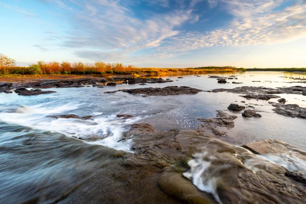
The Mary River Wetlands, situated approximately 150 kilometers east of Darwin, represent one of Australia’s most ecologically significant and densely populated estuarine crocodile habitats. Spanning a prodigious landscape of lily-fringed lagoons, vast verdant floodplains, dense monsoon forests, and mangrove-fringed tidal reaches, the region operates both as a protected national park and a premier destination for anglers, naturalists, and adventure travelers. Unlike the commercialized jumping crocodile cruises closer to the Northern Territory capital, the Mary River offers a raw, unfiltered encounter with Australia’s Top End wilderness. However, managing this delicate ecosystem requires balancing burgeoning tourism with strict conservation protocols, especially given its vulnerability to seasonal weather shifts and saltwater intrusion.
Historical Context and Chronological Development
The European history of the Mary River region is inextricably linked to the exploratory efforts of the 19th century. In 1862, pioneering explorer John McDouall Stuart reached the banks of the Mary River near the conclusion of his historic, cross-country expedition. Stuart successfully mapped a 3,540-kilometer route from Port Augusta to Port Darwin, effectively opening Australia’s mysterious interior to eventual settlement and infrastructure development.
The geographical integrity of the wetlands underwent a significant anthropogenic alteration in the late 1980s. Authorities constructed a concrete barrage across the Mary River to prevent saline water from the Arafura Sea from migrating upstream, a measure designed to protect the fragile freshwater ecosystems vital to native species. While the structure partially achieved its hydrological goals, it failed to impede the movement of estuarine crocodiles and resilient marine life, creating a unique ecological bottleneck that continues to define the area’s dynamics today.
Ecological Significance and Wildlife Dynamics
The Mary River National Park functions as a critical sanctuary for a diverse array of Australian fauna. The region’s hydrological cycle is governed by the tropical wet and dry seasons. Following the monsoon run-off, the wetlands purge millions of gallons of water toward the sea, sweeping aquatic life over the Shady Camp barrage and creating a natural feeding frenzy.
Apex predators, particularly estuarine crocodiles (Crocodylus porosus), congregate below the concrete barrier to harvest displaced barramundi (Lates calcarifer). Concurrently, native fish species such as powerful mullet demonstrate remarkable tenacity by scaling the rushing waters against the tide. This interaction draws numerous avian predators, including sea eagles, cormorants, and nankeen night herons.
Further upstream, the freshwater lagoons host iconic species such as the comb-crested jacana—colloquially known as the "Jesus bird" for its ability to traverse lotus lilies—alongside magpie geese, whistling ducks, jabirus, and agile wallabies. Ecologists note that the region’s biodiversity remains exceptionally high due to the permanence of billabongs like Mistake Billabong, which sustain wildlife populations through the arid dry season.
Tourism Infrastructure and Recreational Opportunities
Tourism within the Mary River National Park contributes significantly to the Northern Territory’s regional economy, particularly through recreational fishing and guided wilderness safaris. The area’s primary hubs are Shady Camp and Couzens Lookout, both of which provide formalized camping infrastructure managed by the Northern Territory Government.
Anglers target prized species including barramundi, spotted saratoga, sooty grunter, and tarpon. To accommodate visitors without private watercraft, commercial operators such as the Point Stuart Wilderness Lodge offer vessel rentals and guided fishing excursions extending from Rockhole Billabong to Chambers Bay. Additionally, businesses operating out of Corroboree Billabong provide small-boat wetland cruises, facilitating wildlife observation with minimal environmental disruption.
Park visitation is heavily dictated by seasonal weather patterns. The Northern Territory Government advises travelers to plan their excursions during the dry season, extending from May to September. During this period, ambient temperatures range comfortably between 20°C and 31°C, and unsealed access roads remain navigable for conventional and four-wheel-drive vehicles. Conversely, the tropical wet season, spanning October to April, frequently induces severe flooding, rendering major access routes impassable and triggering temporary park closures.
Economic and Conservation Implications
The management of the Mary River Wetlands presents an ongoing challenge for environmental authorities. Balancing public access with habitat preservation requires continuous monitoring of fish stocks, water quality, and invasive species.
From an economic perspective, the national park acts as a vital asset for regional tourism operators, generating revenue through permit sales, accommodation bookings, and marine excursion fees. Park entry costs are structured at $10 per day for adults, with discounted rates for children, or $30 for a comprehensive two-week pass applicable across all Northern Territory-operated parks.
Conservationists emphasize that while anthropogenic interventions like the Shady Camp barrage altered natural flow regimes, the broader ecosystem has demonstrated resilience. Strict adherence to biosecurity guidelines, responsible fishing quotas, and seasonal access restrictions remain essential to preserving the ecological integrity of the waterways.
Practical Visitor Information and Logistics
Travelers planning an expedition to the Mary River National Park must adhere to specific logistical preparations to ensure safety and comfort:
- Location and Access: Situated 150 km east of Darwin via the Stuart and Arnhem Highways. Access to Shady Camp requires a 50 km northward drive along Point Stuart Road from the Bark Hut Inn turnoff.
- Best Time to Visit: The cool dry season (May to September) offers optimal weather conditions and safe road transit. Park closures are frequent during the wet season (October to April).
- Accommodation Options: Point Stuart Wilderness Lodge provides air-conditioned rooms and safari tents, alongside dining facilities. National park campgrounds at Shady Camp and Couzens Lookout offer basic amenities, including picnic tables, fire pits, and toilets, priced at $10 per adult per night. Visitors must supply their own drinking water.
- Recreational Activities: Boat ramps are available at strategic locations, including the Arnhem Highway crossing, Rockhole, Shady Camp, Mary River Billabong, Hardies Crossing, and Corroboree Billabong.
- Essential Packing List: Standard preparation should include robust insect repellent (due to persistent mosquito populations during transition periods), high-capacity binoculars, fishing tackle, camping equipment, and firewood.
The Mary River Wetlands continue to serve as a cornerstone of Northern Territory biodiversity and outdoor recreation. Through rigorous management practices and informed tourism, the region preserves its status as one of Australia’s most pristine and accessible wilderness frontiers.



 Diana Nuri Rohmawati

 Gabriela Annisa
 Lukman Taruna Persada Ramadan
 Tatiana Tantri Indah Sari
 Anjar Salim