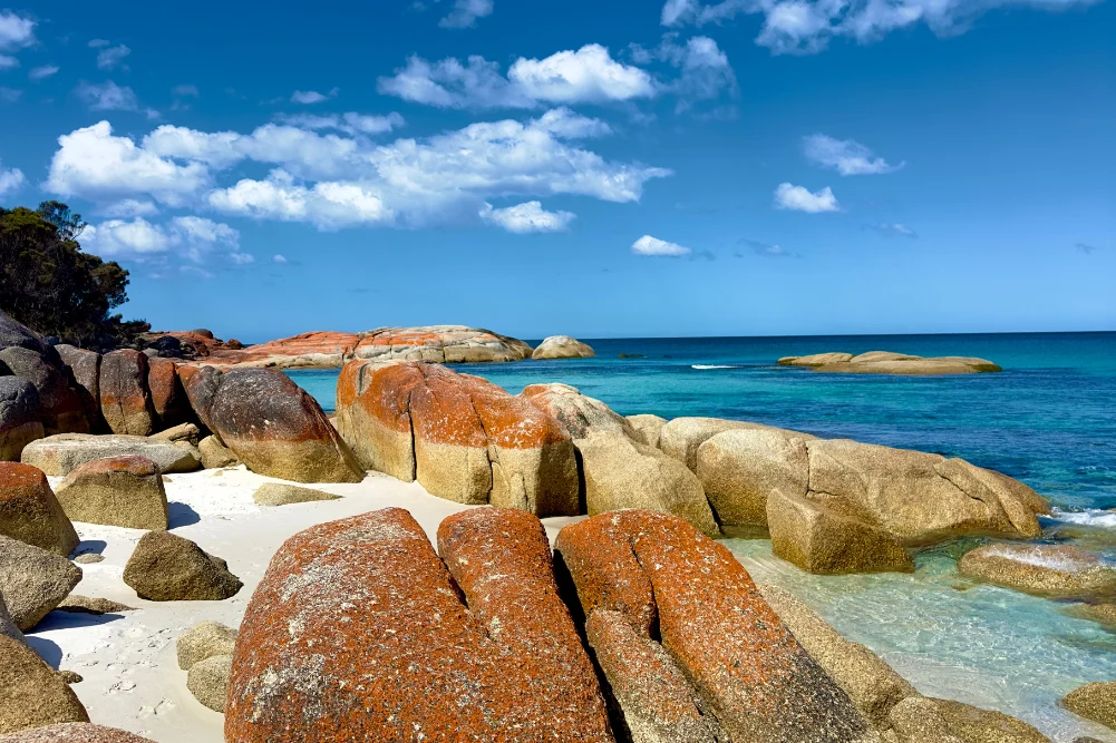
Located approximately 150 kilometers east of Darwin, the Mary River National Park serves as one of the Northern Territory’s most critical ecological sanctuaries and a premier destination for those seeking an authentic encounter with the Australian Top End’s rugged wilderness. While the region is perhaps most famous for harboring the highest concentration of estuarine crocodiles (Crocodylus porosus) in the world, its significance extends far beyond its reptilian inhabitants. The park encompasses a diverse tapestry of landscapes, including lily-fringed lagoons, vast verdant floodplains, dense monsoon forests, and mangrove-lined tidal reaches that connect the interior wetlands to the Arafura Sea. This multifaceted environment supports a complex web of biodiversity that attracts anglers, birdwatchers, and naturalists from across the globe, providing a stark contrast to the five-star comforts of the Darwin waterfront.
The Ecological Framework of the Mary River Wetlands
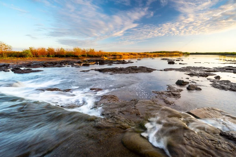
The Mary River system is unique among Northern Territory waterways due to its lack of a single major river mouth. Instead, it spreads across a vast coastal plain, creating an intricate network of billabongs and marshes. This geography makes the region an essential breeding ground for numerous species. The "salties," or estuarine crocodiles, are the apex predators here, but the ecosystem also supports freshwater crocodiles (Crocodylus johnstoni), agile wallabies, and an extraordinary array of avian life.
Conservation efforts within the park are managed by the Parks and Wildlife Commission of the Northern Territory (PWCNT). A pivotal moment in the management of this landscape occurred in the late 1980s with the construction of a barrage—a skinny concrete dam—designed to mitigate the threat of saltwater intrusion. As sea levels rose and feral water buffalo destroyed natural levees, saltwater began to infiltrate the freshwater lagoons, threatening the delicate balance of the upstream habitat. The barrage was intended to safeguard these freshwater reaches, though its effectiveness in restricting the movement of aquatic life is limited, as crocodiles and various fish species frequently navigate the barrier during high tides and seasonal floods.
A Chronology of Exploration: From Stuart to Modern Tourism
The human history of the Mary River is as storied as its natural history. The area gained colonial significance in the mid-19th century during the era of transcontinental exploration.
- 1862: The Stuart Expedition: Pioneering explorer John McDouall Stuart reached the Mary River during his sixth and final expedition. After traversing 3,540 kilometers from Port Augusta in South Australia, Stuart and his party rested on the banks of the river at a site now known as Shady Camp. This expedition was a landmark event in Australian history, as it successfully mapped a route through the continent’s center to the northern coast, eventually facilitating the construction of the Australian Overland Telegraph Line.
- Late 19th and Early 20th Centuries: The region saw sporadic use for pastoralism and buffalo hunting, which significantly altered the landscape as feral populations grew.
- 1980s Infrastructure: The construction of the Shady Camp barrage marked a shift toward active environmental management and the formalization of the area as a recreational hub.
- Modern Era: The establishment of the Mary River National Park has transitioned the local economy from resource extraction and agriculture toward sustainable eco-tourism and conservation.
The "Run-Off" and the Barramundi Economy
For the local economy and tourism sector, the transition between the wet and dry seasons—known as the "run-off"—is the most critical period of the year. As the heavy rains of the monsoon season cease, the vast floodplains begin to drain. This movement of water flushes nutrients and baitfish into the main river channels, triggering a feeding frenzy among barramundi (Lates calcarifer).
The Shady Camp barrage becomes a focal point for recreational anglers during this time. As water plunges over the concrete wall, barramundi congregate to feed on the fish being swept downstream. This creates a high-stakes environment where anglers often stand in close proximity to large estuarine crocodiles. Official safety warnings from the "Be Crocwise" campaign emphasize that crocodiles in this region are highly territorial and move with deceptive speed. Despite these risks, the allure of catching a "metery"—a barramundi exceeding one meter in length—remains a significant drawcard for the Northern Territory’s multi-million dollar recreational fishing industry.
Biodiversity and Avian Populations
The Mary River Wetlands are recognized internationally as a significant bird area. The diversity of habitats ensures a high species richness, particularly during the dry season when water sources elsewhere in the Top End begin to vanish.
- Waterbirds: The wetlands are home to the comb-crested jacana, often called the "Jesus bird" for its ability to walk across lily pads. Other prominent species include the jabiru (Australia’s only stork), magpie geese, and whistling ducks. During the peak of the dry season, the sheer density of these birds creates a sensory spectacle, with flocks numbering in the thousands.
- Raptors and Forest Birds: The monsoon forests, such as those found at Jimmy Creek and Brian Creek, provide shelter for rainbow bee-eaters, sea eagles, and the orange-footed scrub fowl. The latter is known for constructing massive incubation mounds of organic debris, some of which can reach several meters in height.
- Reptilian Dynamics: Beyond the estuarine crocodiles, the park is a sanctuary for the floodplain monitor and various snake species, contributing to a robust food web that sustains the local raptor populations.
Infrastructure and Visitor Management
To balance conservation with public access, the Mary River National Park offers a range of facilities designed to minimize human impact on the environment.
- Shady Camp: This remains the most popular site for camping and boat launching. It provides a rustic experience, though visitors must be self-sufficient with water and supplies.
- Couzens Lookout: Situated on a high bank overlooking a billabong, this site is favored for its panoramic views and sunset vistas. It features managed campgrounds with basic amenities, including fire pits and wheelchair-accessible toilets.
- Point Stuart Wilderness Lodge: For visitors seeking more structured accommodation, the lodge provides rooms and safari tents, acting as a gateway for guided tours and boat rentals.
Access to the park is heavily dependent on seasonal conditions. During the wet season (October to April), many tracks, including the road to Point Stuart and the Shady Camp area, may become impassable due to flooding. The Parks and Wildlife Commission monitors these conditions closely, often closing sections of the park to ensure public safety and prevent damage to the unsealed road network.
Analysis of Implications and Future Outlook
The management of the Mary River Wetlands represents a broader challenge facing the Northern Territory: the reconciliation of tourism growth with environmental preservation. The high density of crocodiles presents a unique branding opportunity for "adventure tourism," yet it necessitates rigorous safety protocols and constant public education to prevent human-wildlife conflict.
Furthermore, the wetlands are a barometer for the impacts of climate change. Rising sea levels pose a persistent threat of saltwater intrusion, which could permanently alter the freshwater ecosystems that support the barramundi and magpie goose populations. The maintenance of the Shady Camp barrage and the potential construction of further levee banks remain subjects of ongoing environmental assessment.
Economically, the Mary River region is a vital component of the Northern Territory’s goal to increase tourism expenditure to $5 billion by 2030. By offering an accessible alternative to the more distant Kakadu National Park, Mary River captures a significant portion of the "drive market"—local and interstate travelers who contribute to the viability of regional businesses like the Bark Hut Inn and Point Stuart Wilderness Lodge.
Conclusion for Travelers and Stakeholders
For those planning a visit, the Mary River Wetlands offer a raw and unfiltered perspective on the Australian tropics. Success in navigating this environment requires a respect for the seasonal cycles and a commitment to safety, particularly regarding the crocodile populations. As the Northern Territory government continues to invest in park infrastructure and conservation programs, the Mary River National Park is poised to remain a cornerstone of Australia’s natural heritage, preserved for both its historical legacy and its ecological future. Visitors are encouraged to arrive during the dry season (May to September), utilize local expertise for navigation and fishing, and adhere to the "leave no trace" principles to ensure the continued health of this vital wetland system.