 Walid Sujud Trenggono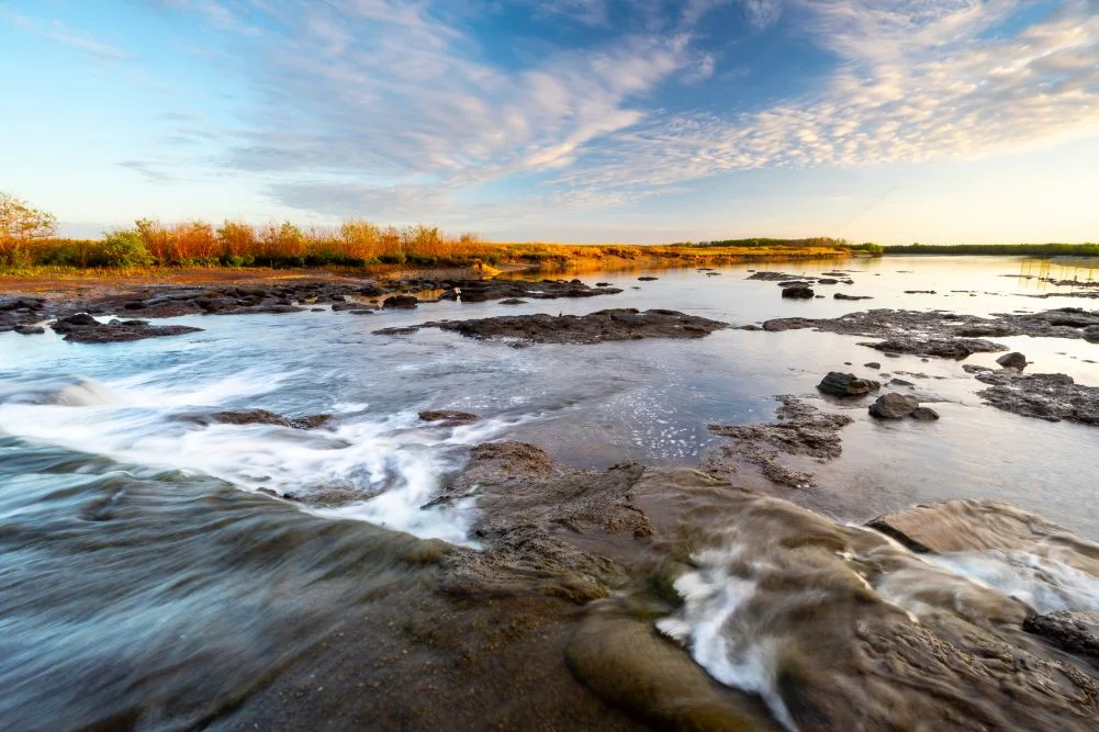
Situated a mere 150 kilometers east of Darwin’s urban waterfront, the Mary River National Park encompasses a sprawling, ecologically vital sanctuary characterized by lily-fringed lagoons, verdant floodplains, dense monsoon forests, and mangrove-lined tidal reaches. While the Northern Territory’s tourism marketing frequently highlights the high-octane "jumping crocodile" cruises closer to the capital, the Mary River wetlands offer a more profound, remote, and ecologically dense encounter with the Australian wilderness. Supporting the highest concentration of estuarine crocodiles (Crocodylus porosus) anywhere on Earth, this dynamic landscape serves as a crucial habitat for apex predators, migratory bird species, and prized sportfish, presenting both a flourishing ecosystem and a complex challenge for regional wildlife and water resource management.
Historical Context and Chronological Development
The documented history of the Mary River region is deeply intertwined with the pioneering era of Australian inland exploration. In 1862, legendary explorer John McDouall Stuart reached the banks of the lower Mary River near the conclusion of his historic, grueling cross-country expedition. Having successfully charted a 3,540-kilometer route from Port Augusta in South Australia to the northern coast—ultimately opening up the continent’s mysterious interior—Stuart paused to camp in the shaded area now appropriately designated as Shady Camp.
For decades following Stuart’s expedition, the region remained largely untamed, utilized primarily by pastoralists and remote travelers. However, by the late 1980s, mounting ecological concerns regarding saltwater intrusion into vulnerable freshwater habitats prompted government intervention. In an attempt to safeguard the upstream ecosystem from the encroaching tidal influences of the Arafura Sea, authorities constructed a concrete barrage across the Mary River at Shady Camp. While the structure partially mitigated upstream saltwater migration, it inadvertently created a unique hydrological and biological phenomenon, establishing a focal point for both marine life movement and intense recreational angling.
Hydrological Dynamics and Ecosystem Interactions
The ecological functionality of the Mary River Wetlands is fundamentally governed by the Top End’s distinct seasonal cycle, punctuated by the long wet season followed by the dry season run-off. During the wet-to-dry transition period, massive volumes of water drain from the sodden marshes and river systems, rushing swiftly toward the sea. This hydraulic purge carries aquatic life downstream, fundling hapless fish over the Shady Camp barrage where estuarine crocodiles lie in wait, positioning themselves with their massive tails swaying slowly in the current.
Despite the turbulence and the presence of apex predators, the barrage zone demonstrates the remarkable resilience and instinct of native fauna. Powerful mullet can be regularly observed doggedly scaling the concrete barrier against the rushing tide, forcing their way into the freshwater pool above. This migration triggers a feeding frenzy among local raptors and piscivores, including sea eagles, cormorants, and juvenile nankeen night herons.
Beyond the immediate vicinity of the barrage, the broader wetland complex supports an immense diversity of flora and fauna. The permanent billabongs and seasonal floodplains provide vital sanctuaries for light-footed jacanas—colloquially known as "Jesus birds" for their ability to walk seemingly on water across pink lotus lilies—as well as vast flocks of magpie geese, whistling ducks, and solitary jabirus. Terrestrial species, including agile wallabies and floodplain monitors, frequent the grassy margins, while freshwater crocodiles (Crocodylus johnstonii) inhabit the fringes of the waterways.
Recreational Tourism and Economic Impact
The Mary River National Park is a cornerstone of the Northern Territory’s nature-based tourism economy, attracting anglers, hikers, and wildlife enthusiasts from across Australia and internationally. The park’s accessibility—reachable via a two-hour drive from Darwin along the Stuart and Arnhem Highways—makes it a prime destination for independent travelers and eco-tourists.
Angling represents a major economic driver for the region, particularly during the winter dry season when receding waters concentrate barramundi (Lates calcarifer) in the tidal reaches and billabongs. In addition to barramundi, anglers target species such as spotted saratoga, sooty grunter, and tarpon. Recreational access is supported by a network of boat ramps located at strategic points including the Arnhem Highway crossing, Rockhole Billabong, Shady Camp, and Hardies Crossing.
Commercial operators, such as the Point Stuart Wilderness Lodge and various independent cruise providers based at Corroboree Billabong, bolster the local tourism infrastructure. These operators offer guided fishing safaris, multi-passenger wetland cruises, and small boat hire, ensuring that visitors without private watercraft can safely experience the aquatic ecosystems. Guided tours typically emphasize early morning wildlife viewing, offering guaranteed sightings of both estuarine and freshwater crocodiles alongside prolific bird populations.
Conservation and Environmental Management
Managing a landscape as ecologically sensitive and potentially hazardous as the Mary River requires rigorous oversight by Northern Territory park authorities. The primary management priorities involve balancing public recreational access—particularly swimming, camping, and boating—with strict public safety protocols regarding estuarine crocodiles. Signage throughout the national park explicitly warns visitors of the dangers posed by these apex predators, reinforcing the fundamental rule that human activity must remain cautious and distant from the water’s edge, particularly along tidal rivers and unrehearsed banks.
Furthermore, conservationists monitor the ecological impacts of artificial barriers like the Shady Camp barrage. While engineered structures aim to preserve freshwater ecosystems from hyper-salinization, they permanently alter natural flow regimes and fish migration patterns. Ongoing scientific assessment ensures that the park’s fragile monsoon forests, permanent billabongs, and mangrove habitats are protected against unauthorized land use, invasive weed species, and the pressures of increasing visitor numbers during peak dry-season months.
Practical Visitor Information and Infrastructure
For travelers planning an excursion to the Mary River National Park, timing and preparation are critical determinants of a safe and successful journey.
Timing and Access
The optimal window for visitation spans the cool dry season, running from May to September. During this period, daytime temperatures consistently range from a comfortable 20°C to 31°C, skies remain clear, and park roads are generally accessible to conventional two-wheel-drive vehicles. Conversely, the tropical wet season—extending from October to April—brings severe monsoonal flooding that frequently inundates roads and necessitates temporary park closures. Park entry fees apply, with standard daily passes or two-week multi-park permits available for purchase.
Accommodation and Facilities
A range of accommodation options caters to diverse visitor preferences. The Point Stuart Wilderness Lodge offers structured lodge rooms and fan-cooled safari tents, complemented by an on-site restaurant, bar, and swimming pool. For self-sufficient travelers, the national park manages designated campgrounds at Couzens Lookout and Shady Camp. These sites feature basic infrastructure, including picnic tables, fire pits, and wheelchair-accessible toilets. Campers are strictly advised to bring adequate supplies of drinking water, firewood, and effective mosquito repellent, as the wetlands are notoriously populated by biting insects during transitional weather periods.
Boating and Exploration
Boating enthusiasts utilizing the park’s network of ramps must exercise extreme caution, adhering strictly to Northern Territory safety guidelines regarding crocodile management. Whether navigating the maze of freshwater channels from Rockhole Billabong or traversing the historic trails leading to the Stuart Tree Memorial Cairn, visitors are encouraged to consult official Northern Territory parks resources prior to departure to ensure up-to-date road conditions and safety alerts.




 Anjar Salim
 Chandra Hamzah
 Tatiana Tantri Indah Sari
 Budi Mulyono
 Lukman Taruna Persada Ramadan