
 Walid Sujud Trenggono
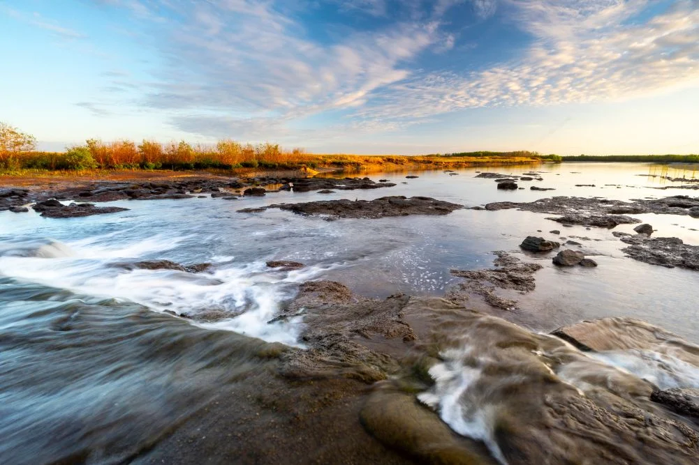
The Mary River National Park, situated approximately 150 kilometers east of Darwin, represents one of Australia’s most ecologically significant and densely populated estuarine crocodile habitats. Spanning a vast expanse of lily-fringed lagoons, verdant floodplains, dense monsoon forests, and mangrove-lined tidal reaches, the park serves as a critical sanctuary for both endemic wildlife and recreational anglers. Despite its proximity to the urban comforts of the Northern Territory capital, the wetlands retain a primitive and rugged character that demands careful navigation, particularly during the dynamic seasonal transitions between the tropical wet and dry periods.
Geographical and Environmental Context
The Mary River catchment covers thousands of square kilometers, funneling seasonal monsoon rains from the interior toward the Arafura Sea. This massive hydrological system creates diverse microhabitats, including freshwater billabongs, saltwater tidal channels, and extensive paperbark and monsoon forests. In the late 1980s, environmental managers constructed a concrete barrage across the Mary River at Shady Camp. The primary objective of this infrastructure project was to prevent saltwater intrusion from degrading the upstream freshwater habitats that support a fragile equilibrium of endemic flora and fauna.
While the barrage successfully altered hydrological flows, it failed to restrict the movement of estuarine crocodiles and various aquatic species. Consequently, the concrete structure has evolved into a unique intersection point where human recreation, particularly barramundi fishing, meets apex predators.
Chronology of Exploration and Access
The modern historical footprint of the Mary River region is inextricably linked to nineteenth-century Australian exploration. In 1862, pioneering explorer John McDouall Stuart reached the banks of the Mary River near the conclusion of his historic, successful transcontinental expedition. Stuart had forged a 3,540-kilometer route from Port Augusta in South Australia to the northern coast, effectively opening the continent’s interior to subsequent pastoral and infrastructural development.
Access to these historical sites and remote wilderness areas remains strictly governed by seasonal weather patterns. The tropical Top End experiences distinct wet and dry seasons, with heavy monsoonal rains rendering unsealed park roads impassable from October through April. Mainstream tourism and vehicular access typically resume during the cool dry season, spanning from May to September. During this window, daytime temperatures stabilize between 20 and 31 degrees Celsius, offering optimal conditions for camping, hiking, and wildlife observation.
Fisheries Management and Angling Dynamics
The Mary River Wetlands are internationally renowned for recreational fishing, specifically targeting the iconic barramundi (Lates calcarifer). The peak fishing period aligns with the annual "run-off," which occurs as floodwaters recede following the wet season. During this period, millions of litres of water drain from the marshes, carrying disoriented fish over the Shady Camp barrage.
Anglers congregate near the structure to exploit this natural feeding frenzy, casting lines into turbulent waters while estuarine crocodiles—colloquially known as "salties"—patrol the churning currents below. In addition to barramundi, the river system yields spotted saratoga, sooty grunter, and tarpon. Fisheries management authorities closely monitor catch rates and enforce size and possession limits to ensure the sustainability of the region’s aquatic ecosystems against the pressures of growing recreational tourism.
Biodiversity and Avian Populations
Beyond its aquatic predators, the Mary River National Park functions as a premier destination for ornithologists and wildlife enthusiasts. The wetlands support significant populations of waterbirds, raptors, and endemic fauna. Visitors frequently observe comb-crested jacanas, locally termed "Jesus birds," walking effortlessly across aquatic lotus leaves, alongside whistling ducks, magpie geese, jabirus, and sea eagles.
Monsoon forest walks, such as the Jimmy Creek and Brian Creek trails, offer visitors immersive encounters with terrestrial species, including agile wallabies, floodplain monitors, and orange-footed scrubfowl. However, the ecosystem also hosts substantial populations of pest species and biting insects, notably aggressive mosquitoes that emerge in large swarms during twilight hours, necessitating thorough preparation by campers and hikers.
Infrastructure and Tourism Operations
Tourism infrastructure within Mary River National Park is designed to balance visitor safety with remote wilderness engagement. Managed campsites, such as those at Couzens Lookout and Shady Camp, provide essential amenities including picnic tables, fire pits, and toilet facilities. Concessionaires, most notably the Point Stuart Wilderness Lodge, supplement these public facilities by offering permanent accommodation, guided fishing safaris, boat rentals, and scenic wetland cruises.
Operators on the western side of the river, including Wildlands and Corroboree Billabong Wetland Cruises, facilitate access to alternative waterways via the Arnhem Highway. These commercial operations provide structured platforms for tourists to observe crocodiles and prolific birdlife without compromising natural habitats or breaching safety protocols regarding apex predators.
Socioeconomic Implications and Conservation Outlook
The accessibility of the Mary River Wetlands—located a mere two-hour drive from Darwin—presents both economic opportunities and conservation challenges. Regional tourism generates significant revenue for the Northern Territory, supporting local lodges, tour operators, and hospitality providers. Concurrently, environmental agencies must manage visitor impact to protect sensitive riparian zones from erosion, littering, and unmanaged campfires.
Conservation strategies focus on maintaining water quality, preserving indigenous flora, and enforcing strict biosecurity and safety guidelines regarding estuarine crocodiles. As climate patterns shift and regional tourism demand fluctuates, the long-term preservation of the Mary River ecosystem depends on proactive monitoring by the Northern Territory Government’s Parks and Wildlife Commission. Through balanced regulatory frameworks, the sanctuary continues to function as both a vital ecological reserve and a premier destination for wilderness exploration in Australia’s Top End.



 Gabriela Annisa

 Lukman Taruna Persada Ramadan
 Tatiana Tantri Indah Sari
 Anjar Salim

 Dwi Wanna
