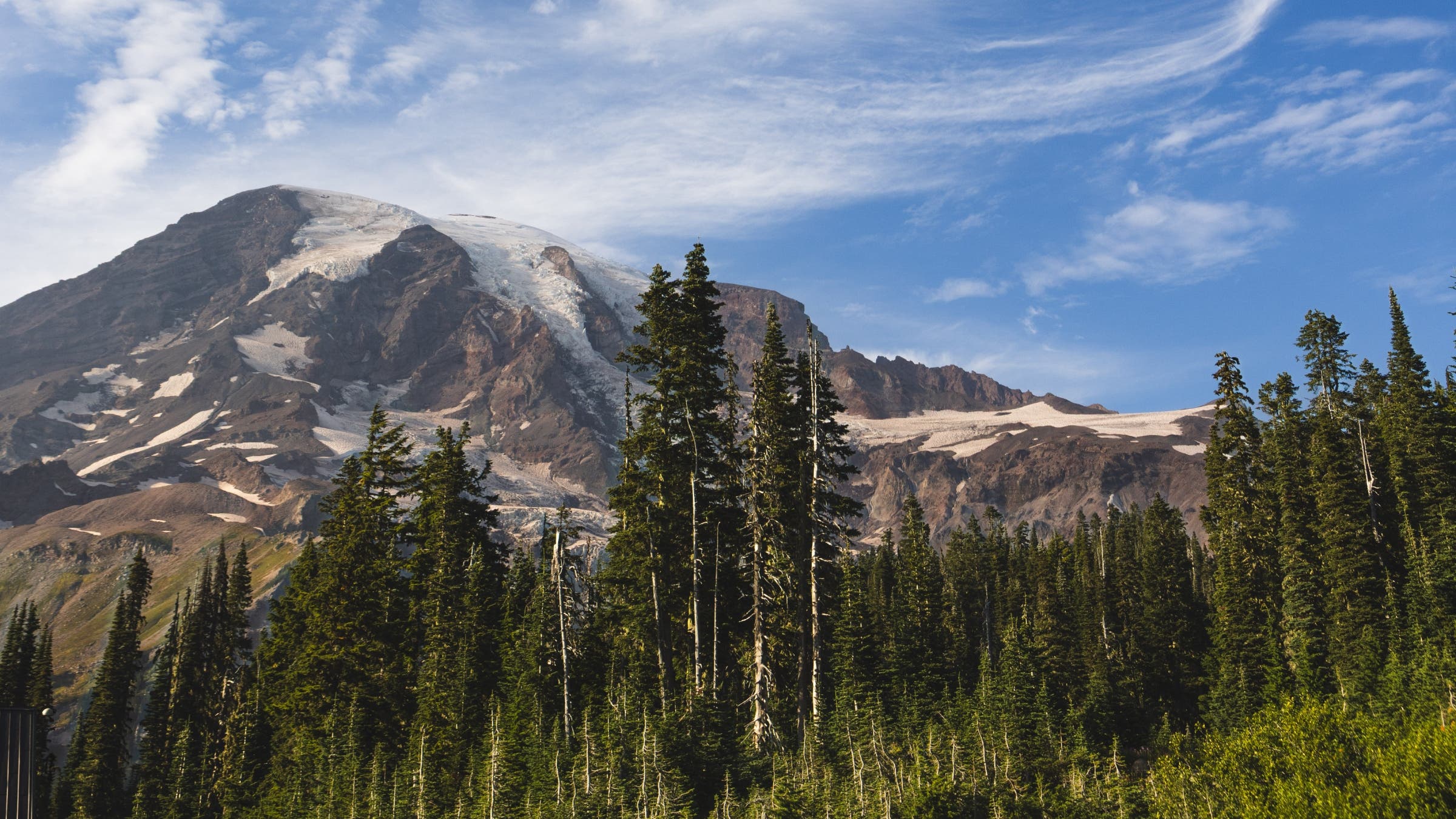
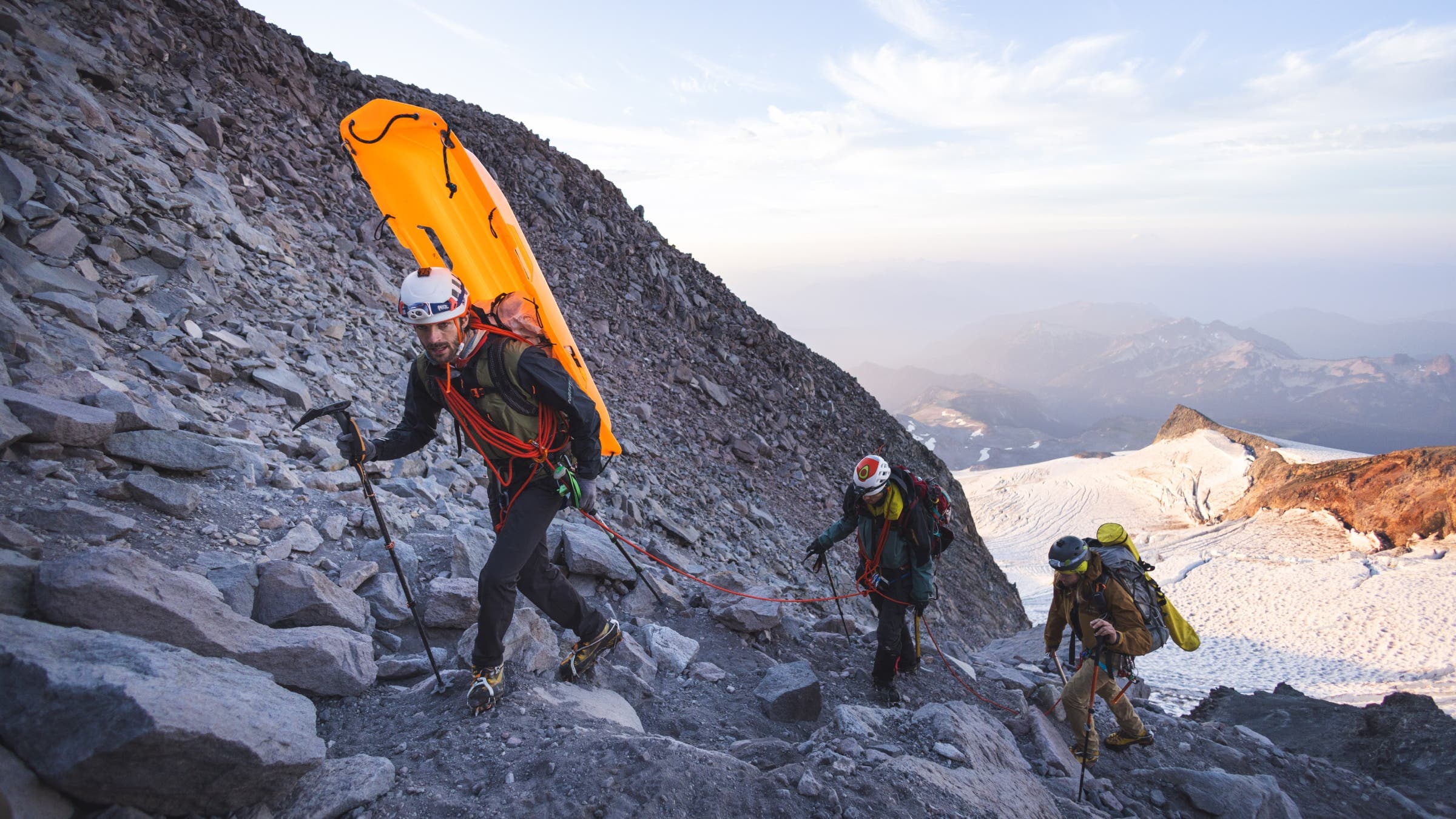
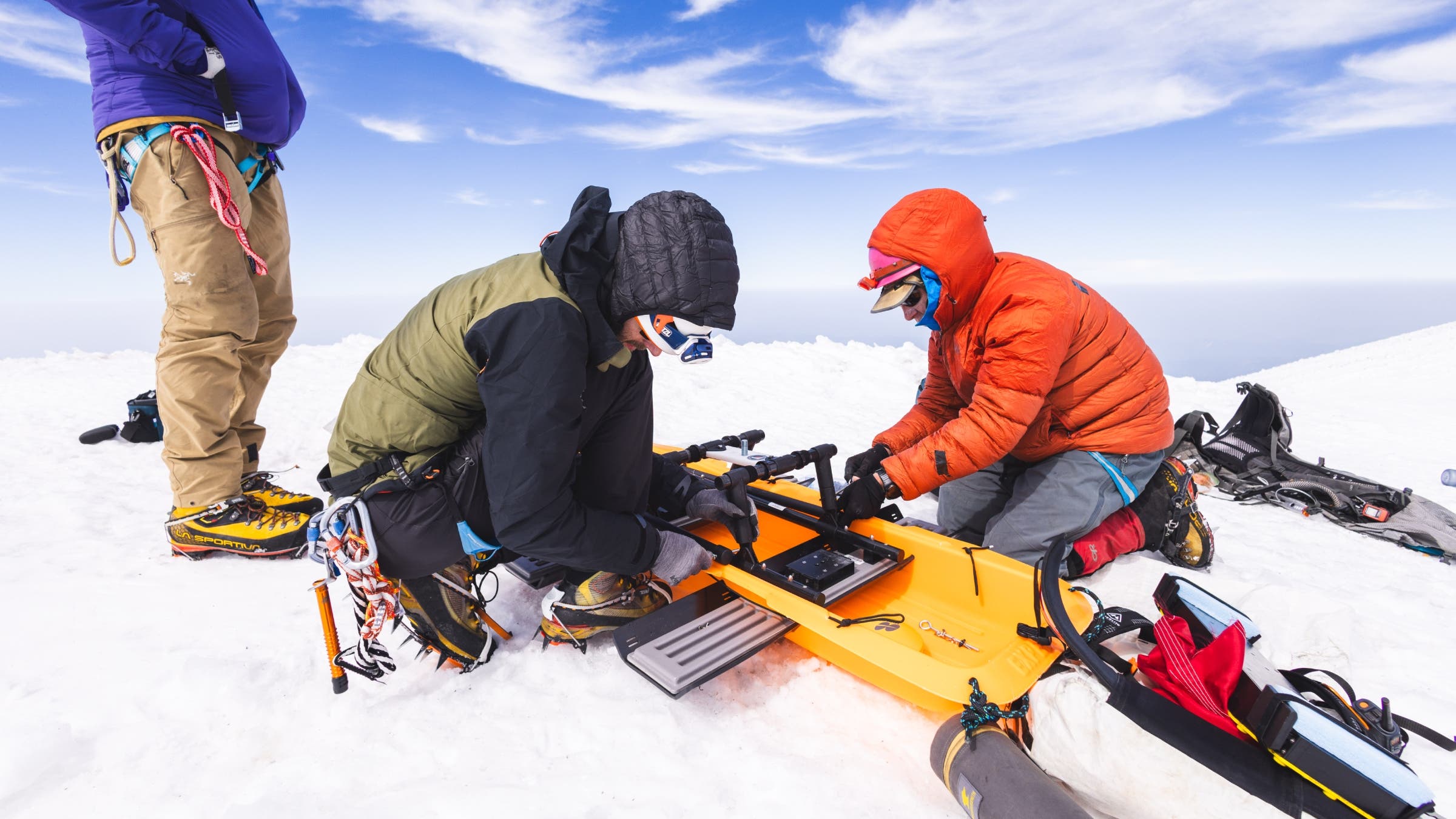
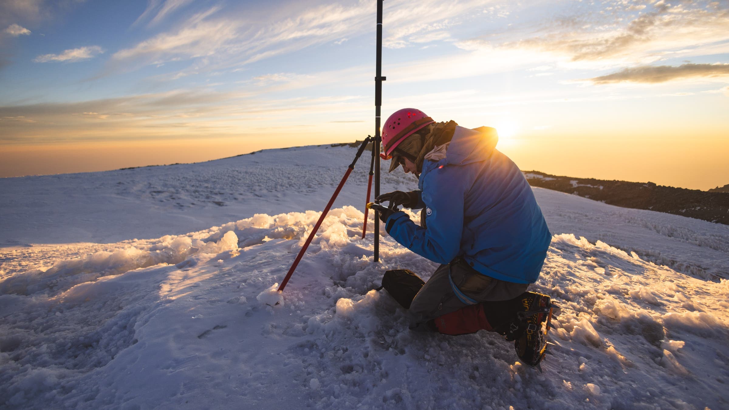
At 5:00 a.m. on a clear morning in May 2026, a specialized team of climbers and surveyors navigated the steep, icy slopes of Mount Rainier with a level of urgency typically reserved for military operations. While most recreational climbers aim for the summit as a personal milestone, this group, led by Eric Gilbertson, an associate teaching professor of mechanical engineering at Seattle University, carried a different burden: professional-grade Global Navigation Satellite System (GNSS) receivers and ground-penetrating radar. Their objective was to resolve a growing geographical controversy and determine, to the nearest inch, the true elevation of Washington state’s most iconic peak.
The mission required synchronized precision. While Gilbertson’s team ascended toward the 14,000-foot mark, secondary teams were stationed at established U.S. Geological Survey (USGS) markers at the Paradise Visitor Center, McClure Rock, and the Camp Muir helipad. The goal was to record two hours of concurrent satellite data across five locations to eliminate atmospheric distortions that frequently plague high-altitude GPS readings. This effort was not merely academic; it was a response to mounting evidence that Mount Rainier, long officially recorded at 14,410 feet, is physically shrinking.

The Discrepancy: Why 14,410 Feet is Under Question
For decades, the height of Mount Rainier has been a settled matter of public record. The official elevation of 14,410 feet was calculated in 1956 using manual surveying techniques, carrying a two-foot margin of error. Subsequent GPS measurements in 1988 and 1999 suggested a slightly higher elevation of 14,411 feet. However, recent data suggests these figures no longer reflect the mountain’s physical reality.
Gilbertson’s previous surveys in 2024 indicated that the summit had dropped to 14,399.6 feet. The discrepancy lies in the melting of Columbia Crest, a massive mound of ice that has historically served as the mountain’s highest point. Gilbertson’s research suggests that the true summit is no longer this ice dome, but rather a small rocky outcrop approximately 150 yards away. This shift marks a significant geological transition: Mount Rainier is transforming from an ice-capped peak into a rock-capped one.
The Evolution of Geodetic Measurement
To understand the complexity of measuring a mountain, one must look at the history of geodesy—the science of measuring Earth’s geometric shape and gravity field.
From Survey Chains to Satellites
In the 19th century, mountains were measured using heavy chains of known lengths or through trigonometry from a distance. These methods were prone to human error and rounding. After World War II, photogrammetry allowed for measurements based on aerial photography, but absolute precision remained elusive. NASA’s 2000 Shuttle Radar Topography Mission provided a global map, but its 30-meter resolution left a significant margin of error for narrow summits.
The Problem of "Sea Level"
Perhaps the greatest challenge in determining elevation is the definition of sea level. Historically, the United States used the National Geodetic Vertical Datum of 1929 (NGVD 29), based on average tide levels. This was updated to the North American Vertical Datum of 1988 (NAVD 88), which accounted for variations in Earth’s gravity. However, NAVD 88 has been found to be "tilted," with errors of up to one meter in the Pacific Northwest.
The National Geodetic Survey is currently transitioning to the North American-Pacific Geopotential Datum of 2022 (NAPGD2022). This new system relies on a "geoid model"—a theoretical representation of where the oceans would rest if currents and tides ceased, shaped entirely by gravity. Because mountains possess immense mass, they actually pull the sea level toward them, complicating the "zero point" from which height is measured.
A Timeline of Recent Expeditions
The current push to re-measure Rainier is the culmination of several years of data collection by Gilbertson and his late climbing partner, Ross Wallette.
- August 2024: Gilbertson and Wallette conduct the first modern GNSS survey, recording a height of 14,399.6 feet.
- September 2024: A follow-up survey is conducted to confirm the August data, yielding consistent results.
- May 2025: Gilbertson measures the summit during peak snowpack to compare seasonal variations.
- May 2026: The current "military-scope" mission utilizes multiple ground stations and ground-penetrating radar to measure the remaining ice thickness on Columbia Crest.
Institutional Resistance and the Wikipedia War
Despite the precision of Gilbertson’s equipment—provided in part by the geospatial technology firm Trimble—his findings have met significant institutional resistance. When an anonymous user attempted to update Mount Rainier’s elevation on Wikipedia, editors rejected the change, citing a lack of "official" recognition from the National Park Service (NPS) or peer-reviewed journals.
Scott Beason, a geologist for Mount Rainier National Park, urged caution, stating that a single individual’s measurements could not supersede federal records without extensive internal review. Furthermore, prominent Seattle meteorologist Cliff Mass challenged the notion that the summit was melting, arguing that temperatures at 14,000 feet remain too cold for significant ice loss.

However, glaciologists like Mauri Pelto of Nichols College have provided data refuting this skepticism. Records indicate that during the summer of 2025, the summit of Rainier experienced 35 days with temperatures above freezing, including a six-day stretch where temperatures never dropped below 32 degrees Fahrenheit. Pelto’s analysis supports Gilbertson’s findings: the ice is retreating, and it is doing so at a measurable rate.
The Human Cost of Precision
The quest for accuracy has not been without tragedy. In late 2025, during a survey of Fury Finger in Washington’s North Cascades, Ross Wallette suffered a fatal fall. Wallette had been Gilbertson’s primary partner in the project, documenting the expeditions and hauling heavy equipment across the state’s highest peaks.
The loss of Wallette added a somber layer to the May 2026 Rainier climb. While the team remained focused on the technical requirements of the GNSS readings, the mission had evolved into a tribute to Wallette’s dedication to geographical truth. Gilbertson, known for his stoic demeanor and world-class mountaineering resume—including highpointing over 150 countries and earning the rare Snow Leopard award—continued the work with a renewed sense of purpose.
Data Analysis: The Future of Washington’s Peaks
The data processed from the 2026 expedition provides a stark look at the future of the Pacific Northwest landscape.
- Linear Melting Rate: The ice at Columbia Crest is melting at a rate of approximately 0.9 feet per year. At this pace, the historical ice summit will be entirely gone by 2045.
- Summit Migration: The true high point of Mount Rainier has officially migrated from the ice of Columbia Crest to a nearby rock pinnacle. This transition likely occurred around 2014, though it went unrecorded by official agencies at the time.
- Regional Decline: Rainier is not alone. Gilbertson’s surveys of other ice-capped peaks in Washington, including Colfax, Liberty Cap, and Eldorado, show height losses ranging from 15 to 30 feet over the last two decades.
- The Last Ice: Liberty Cap is projected to be the only perennially snow-covered summit in the lower 48 states by the end of the current year, though it too is expected to melt out by 2046.
Official Responses and Next Steps
The National Park Service has acknowledged Gilbertson’s academic contributions but remains hesitant to update official maps. In a statement released shortly after the 2026 survey, a park spokesperson noted that while the measurements themselves are not suspect, the agency requires a "standardization of datums" before making a formal change. The park requested clearer distinctions between bedrock elevation and ice elevation to ensure long-term data consistency.
For the National Geodetic Survey to benchmark a new official height, federal protocols require two sets of consistent measurements taken on different days. Consequently, Gilbertson plans to return to the summit in August 2026 to complete the final requirement for a formal database update.
Implications of a Shrinking Mountain
The shrinking of Mount Rainier serves as a high-altitude barometer for climate change. While tectonic plates continue to push the mountain upward at a rate of a few millimeters per year, the loss of glacial ice is outstripping geological growth by a factor of nearly a hundred.
The transition of Rainier’s summit from ice to rock is more than a statistical curiosity; it represents a fundamental shift in the identity of "The Mountain." For the millions of residents who view the peak daily from the Puget Sound region, the 14,410-foot figure is a point of cultural pride. Correcting that number to 14,399.6 feet—or whatever the final NAPGD2022 calculation yields—is a necessary, if painful, step in acknowledging the changing state of the natural world.
As the team descended back to the Paradise parking lot on the morning after their survey, they left behind a mountain that is, by all scientific accounts, no longer the same giant it was a generation ago. The quest for precision continues, proving that even the most permanent symbols of the Earth are subject to the relentless forces of change.