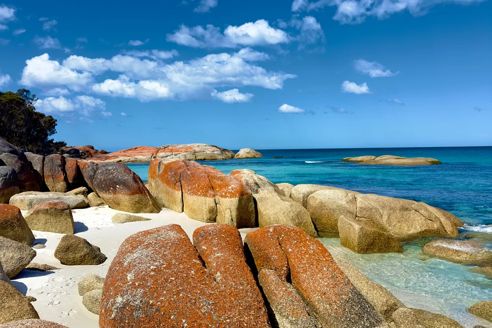
The Indian Ocean Drive, a 277-kilometer stretch of sealed road connecting Lancelin to Dongara, has transformed the tourism landscape of Western Australia since its completion in 2010. By providing a scenic alternative to the inland Brand Highway, the route has opened the state’s Mid West coastline to a surge of domestic and international travelers. This coastal artery serves as the primary gateway to the Coral Coast, a region defined by its diverse ecosystems, ancient geological formations, and a maritime history that dates back to the 17th-century Dutch explorers. Spanning roughly 600 kilometers from Perth to the Murchison River, the journey encompasses a series of distinct environmental zones, from the shifting parabolic dunes of Lancelin to the rugged sandstone gorges of Kalbarri.
The Southern Gateway: Lancelin and the Adventure Economy
The expedition begins approximately 127 kilometers north of Perth in Lancelin, a township historically rooted in the fishing industry but increasingly reliant on adventure tourism. Known to the local Yued people as Wangaree, meaning "fish," Lancelin remains a critical hub for the Western Rock Lobster (Panulirus cygnus) industry. The local economy is bolstered by the export of these crustaceans, which contribute significantly to Western Australia’s multi-million dollar seafood sector.
Geographically, the town is famous for the Lancelin Sand Dunes, the largest of their kind in the state. Stretching for two kilometers, these dunes are a premier destination for sandboarding and off-road vehicle enthusiasts. Beyond the dunes, the Lancelin Island Nature Reserve, situated 700 meters offshore, provides a sanctuary for diverse avian species and a resident population of Australian sea lions. The waters surrounding the island are a graveyard for maritime history, containing at least 14 known shipwrecks, which now serve as part of a popular dive trail. This intersection of commercial fishing, ecological preservation, and recreational sports forms the foundational economic pillar of the southern Coral Coast.
Geological Antiquity: The Pinnacles of Nambung National Park
Continuing north, the landscape transitions into the Nambung National Park, home to the Pinnacles Desert. These limestone spires, some reaching heights of four meters, are the remnants of an ancient seabed. Geologists suggest the structures formed approximately 25,000 to 30,000 years ago after the sea receded and left deposits of sea shells. Over millennia, coastal winds removed the surrounding loose sand, exposing the calcified pillars.
The Pinnacles hold deep cultural significance for the Yued people, who associate the landscape with the Wagyl, the creator serpent of Noongar Dreaming. Historically, early Dutch maritime explorers viewed these spires from the sea, mistakenly identifying them as the ruins of a lost city. Today, the park is a major driver of regional tourism, managed by the Department of Biodiversity, Conservation and Attractions (DBCA). To manage the influx of visitors while preserving the fragile desert pavement, the DBCA maintains a one-way loop drive and a dedicated Discovery Centre that provides scientific context on the region’s karst topography.
Marine Conservation and the Mid West Coastline
Further north lies Jurien Bay, a region that has successfully pivoted from a predominantly pastoral and fishing community to a center for marine conservation and eco-tourism. The Jurien Bay Marine Park, established in 2003, protects a massive limestone reef system and extensive seagrass meadows. These meadows are essential nurseries for the Western Rock Lobster and provide foraging grounds for the endangered Australian sea lion (Neophoca cinerea).
Jurien Bay is one of the few places in the world where visitors can interact with these rare pinnipeds in their natural habitat. Major breeding colonies are located on Buller Island and North Fisherman Island. Access to these islands is strictly regulated to prevent the disturbance of breeding cycles. According to regional tourism data, the growth of sea lion tours has significantly boosted the local hospitality sector, encouraging longer visitor stays.
Complementing the marine life is the maritime heritage of Green Head and Dynamite Bay. The area is synonymous with the 1656 wreck of the Vergulde Draeck (Gilt Dragon), a Dutch East India Company ship. The discovery of silver treasure by divers in the 1960s cemented the "Shipwreck Coast" moniker. This history is meticulously preserved in regional museums, highlighting the treacherous nature of the Western Australian coastline, which has claimed over 1,600 ships since the 1600s.
Subterranean Exploration and the Wildflower Way
The transition from the coast to the hinterland reveals the Stockyard Gully Caves, located within the Beekeepers Nature Reserve. This 250-meter-long limestone tunnel was formed by an ancient river system. Historically, the gully served as a crucial campsite for stockmen driving cattle along the coast between Geraldton and Perth in the late 19th century. Today, it offers a unique 4WD-accessible trekking experience.
The region surrounding Stockyard Gully is also a focal point for the Western Australian wildflower season, which typically runs from July to October. Western Australia boasts over 12,000 species of wildflowers, 60% of which are found nowhere else on Earth. The biodiversity of the Mid West is particularly high, featuring endemic species such as the Wreath Flower (Lechenaultia macrantha) and various Banksia and Grevillea species. This botanical phenomenon attracts a specific demographic of "nature tourists," contributing to a seasonal spike in regional revenue.
Geraldton: The Maritime and Historical Hub
As the Indian Ocean Drive merges into the Brand Highway, travelers reach Geraldton, the administrative and commercial heart of the Mid West. Geraldton’s significance is multifaceted, serving as a major grain export port and a center for maritime archaeology. The Museum of Geraldton houses the de Vlamingh Plate and artifacts from the Batavia, a shipwreck synonymous with mutiny and survival.
A somber but essential site in Geraldton is the HMAS Sydney II Memorial. Commemorating the loss of 645 sailors during World War II, the memorial stands on Mount Scott. The ship’s disappearance in 1941 remained one of Australia’s greatest maritime mysteries until its wreckage was located in 2008. The memorial and the associated historical research highlight Geraldton’s role in Australia’s national defense and maritime identity.
Atmospheric Phenomena: The Science of Hutt Lagoon
North of Geraldton, the journey leads to Hutt Lagoon, a 70-square-kilometer salt lake known for its vivid pink hue. The coloration is caused by the presence of the carotenoid-producing algae Dunaliella salina. This microalga produces beta-carotene, a pigment used in food coloring and as a source of Vitamin A.
Hutt Lagoon is not merely a photographic curiosity; it is the site of the world’s largest microalgae production plant. Owned by BASF, the facility harvests the algae for commercial use. The intensity of the lake’s color fluctuates based on salinity levels, temperature, and light intensity, making it a dynamic feature of the Coral Coast landscape. The lagoon represents a successful intersection of natural phenomena and industrial biotechnology.
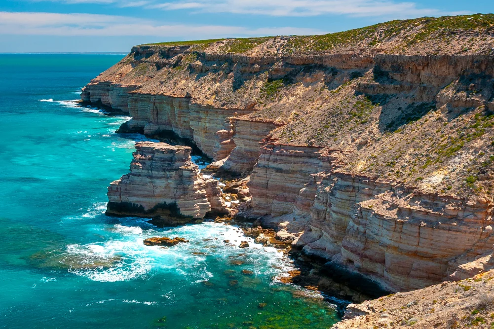
The Northern Frontier: Kalbarri and the Murchison River
The expedition culminates in Kalbarri, where the Murchison River meets the Indian Ocean. Kalbarri National Park, covering over 183,000 hectares, is defined by its 400-million-year-old Tumblagooda Sandstone. The park features dramatic river gorges and coastal cliffs that rise 100 meters above the sea.
In 2020, the Western Australian government invested $24 million in the Kalbarri Skywalk. These two cantilevered walkways project 25 and 17 meters beyond the gorge rim, providing views of the Murchison River 100 meters below. This infrastructure project was designed to modernize the park’s offerings and has since become a centerpiece for regional tourism.
Despite the devastation caused by Tropical Cyclone Seroja in April 2021, Kalbarri has undergone a significant recovery. The resilience of the local community, supported by state grants and tourism initiatives, has ensured that the town remains a premier destination. The Murchison River itself provides a calm contrast to the rugged coast, offering a sanctuary for migratory birds and a recreational space for kayaking and fishing.
Chronology of Development and Infrastructure
The development of this coastal route has followed a clear strategic timeline:
- 1600s–1700s: Dutch explorers chart the coast, resulting in numerous shipwrecks.
- 1800s: Pastoralists and stockmen establish routes between Perth and the North West.
- 1950s–1960s: Lancelin and Jurien Bay emerge as commercial fishing hubs.
- 2010: Completion of the Indian Ocean Drive, linking Lancelin to Dongara.
- 2020: Opening of the Kalbarri Skywalk, enhancing the northern terminus of the route.
- 2021–Present: Post-cyclone reconstruction and a shift toward high-value eco-tourism.
Broader Impact and Regional Implications
The enrichment of the Indian Ocean Drive from a series of disconnected tracks to a world-class tourism route has had profound implications for Western Australia. Economically, it has diversified the income streams of coastal towns that were previously dependent solely on primary industries. Environmentally, the increased foot traffic has necessitated sophisticated management strategies from the DBCA to protect fragile dune systems and endangered marine life.
From a journalistic perspective, the evolution of the Coral Coast reflects a broader global trend toward experiential and nature-based travel. The region’s ability to balance industrial activity—such as lobster fishing and algae harvesting—with conservation and tourism provides a template for sustainable regional development. As climate patterns shift and travel preferences evolve, the Indian Ocean Drive stands as a testament to the enduring appeal of the Australian wilderness, framed by a commitment to preserving both its geological past and its ecological future.