The Mary River Wetlands, situated approximately 150 kilometers east of Darwin, represent one of the most biodiverse and ecologically complex regions in Australia’s Northern Territory. Spanning a vast landscape of lily-fringed lagoons, verdant floodplains, and dense monsoon forests, the Mary River National Park serves as a critical sanctuary for a diverse array of flora and fauna. Most notably, the region is recognized for hosting the highest concentration of estuarine (saltwater) crocodiles per kilometer in the world, making it a focal point for both scientific research and eco-tourism. Unlike the more publicized "jumping crocodile" cruises located closer to the Darwin metropolitan area, the Mary River system offers a more primitive and expansive look into the Top End’s wild interior, attracting anglers, birdwatchers, and history enthusiasts alike.
The Geographical and Ecological Framework of the Mary River
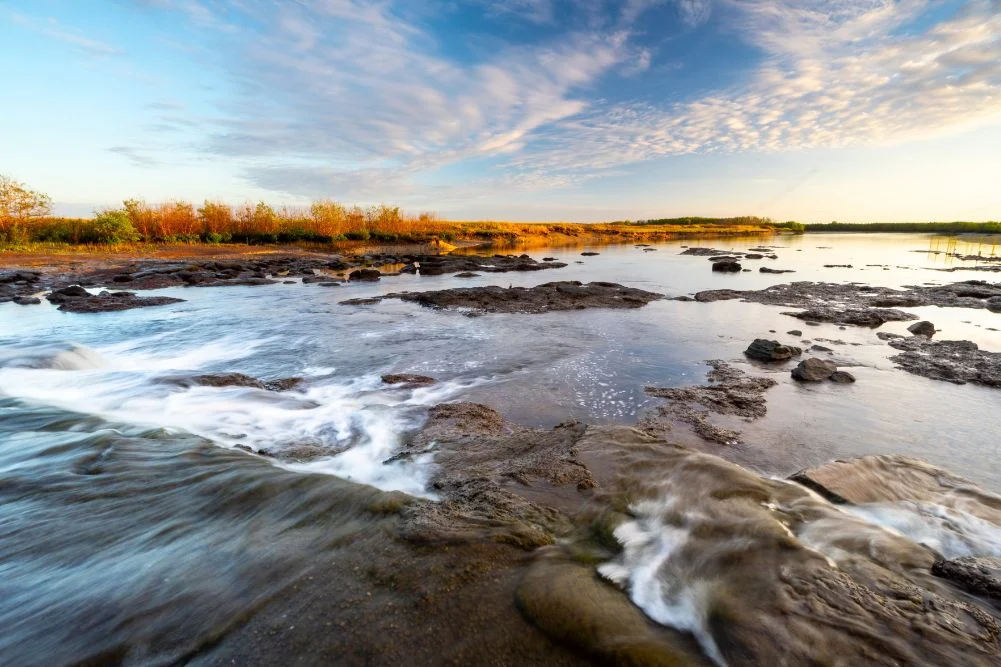
The Mary River National Park is characterized by its distinct lack of a single main channel leading to the sea. Instead, the river spreads across vast coastal plains, creating a network of billabongs, paperbark swamps, and tidal reaches. This unique topography is a result of the region’s dramatic seasonal shifts. During the wet season (October to April), the area receives the bulk of the Northern Territory’s annual rainfall—often exceeding 1,500 millimeters—which transforms the parched earth into a massive, interconnected waterway.
The park is divided into several key zones, including the freshwater lagoons upstream and the saline-influenced tidal reaches near the Arafura Sea. The transition between these environments is managed by a series of man-made structures, most notably the Shady Camp barrage. Constructed in the late 1980s, this skinny concrete dam was an environmental intervention designed to prevent saltwater from intruding into the delicate freshwater wetlands. Saltwater intrusion, exacerbated by the historical impact of feral water buffalo which trampled natural levees, has long threatened the freshwater ecosystems that support the region’s iconic birdlife and barramundi populations.
Historical Chronology: From Exploration to Conservation
The human history of the Mary River is as storied as its natural history. For thousands of years, the region has been the traditional country of the Limilngan and Wulna people, who have maintained a deep spiritual and practical connection to the wetlands.
In the mid-19th century, the region became a focal point for European exploration. The chronology of modern discovery is anchored by the following milestones:
- 1862 – The Stuart Expedition: Explorer John McDouall Stuart reached the Mary River during his sixth attempt to cross the Australian continent from south to north. On July 24, 1862, Stuart and his party arrived at the coast at Chambers Bay, having passed through what is now Shady Camp. This successful expedition opened Australia’s interior to the pastoral and telegraph industries.
- Late 1800s to Mid-1900s – Pastoralism and Feral Proliferation: The introduction of cattle and water buffalo significantly altered the landscape. Buffalo numbers swelled to hundreds of thousands, causing massive erosion and allowing saltwater to breach freshwater systems.
- 1980s – Environmental Intervention: Recognizing the degradation of the wetlands, the Northern Territory government began culling feral buffalo and constructing barrages, such as the one at Shady Camp, to restore the freshwater balance.
- 2000s – National Park Expansion: The Mary River National Park was formally expanded and consolidated, bringing various conservation areas under a unified management plan by the Parks and Wildlife Commission of the Northern Territory (PWCNT).
The "Run-Off" and the Economic Impact of Recreational Fishing
A significant driver of the local economy is recreational fishing, centered primarily on the iconic barramundi (Lates calcarifer). The "run-off"—the period at the end of the wet season when floodwaters recede from the plains into the river channels—is the most anticipated event for anglers. As the water moves, it carries a high concentration of baitfish and nutrients, triggering a predatory frenzy.
At Shady Camp, the barrage becomes a site of high tension between humans and nature. Anglers often stand on the concrete structure to cast into the rushing water, despite the presence of large estuarine crocodiles circling below. While the Northern Territory government issues frequent safety warnings regarding "croc-wise" behavior, the lure of trophy-sized barramundi continues to draw thousands of visitors annually. Beyond barramundi, the river supports populations of spotted saratoga, sooty grunter, and tarpon, contributing to a multi-million dollar fishing tourism industry that supports local lodges and charter operators.
Avian Biodiversity and Wildlife Management
The Mary River Wetlands are recognized as an Important Bird Area (IBA), supporting over 250 species of birds. The diversity of habitats—ranging from open floodplains to closed monsoon forests—allows for a high degree of niche specialization.
- Waterbirds: The wetlands support significant breeding colonies of magpie geese, which can be seen in flocks numbering in the thousands. Other prominent species include the jabiru (Australia’s only stork), the comb-crested jacana (commonly known as the "Jesus bird" for its ability to walk on lily pads), and various species of egrets and herons.
- Predatory Birds: The abundance of fish attracts raptors such as the white-bellied sea eagle and the whistling kite. These birds play a crucial role in the ecosystem by managing fish and small mammal populations.
- Reptilian Management: The coexistence of freshwater crocodiles (Crocodylus johnstoni) and estuarine crocodiles (Crocodylus porosus) in the same river system is a point of scientific interest. While freshwater crocodiles are generally shy and pose little threat to humans, the estuarine crocodiles are apex predators. The PWCNT manages these populations through a combination of public education and the removal of "problem" crocodiles in high-traffic areas, though the Mary River remains a "non-exclusion" zone where crocodiles are allowed to thrive naturally.
Scientific Analysis: The Threat of Climate Change and Invasive Species
Despite its protected status, the Mary River Wetlands face ongoing ecological challenges. Scientific analysis suggests that sea-level rise is the most significant long-term threat to the region. As global sea levels rise, the existing barrages may become insufficient to prevent saltwater inundation. A 2020 study on Northern Territory wetlands indicated that even a modest rise in sea level could convert thousands of hectares of freshwater paperbark forests into saline mudflats, fundamentally altering the biodiversity of the region.
Furthermore, invasive flora such as Mimosa pigra and Salvinia molesta continue to threaten the health of the waterways. These weeds can choke billabongs, reducing oxygen levels in the water and killing fish. Management of these species requires constant vigilance and significant government funding to ensure the wetlands remain navigable and ecologically viable.
Infrastructure and Visitor Experience
The Northern Territory government has invested in infrastructure to make the Mary River National Park accessible while preserving its rugged character. Key locations include:
- Couzens Lookout: Situated on a high point overlooking a bend in the river, this area offers a picturesque campground and a boat ramp. It is a prime location for observing the transition of wildlife during the "golden hour" of sunset.
- Point Stuart Wilderness Lodge: This private facility provides a gateway for those seeking more comfortable accommodations, offering guided safaris and boat rentals. It serves as a hub for the Jimmy Creek Monsoon Forest Walk, a 1.6-kilometer trail that showcases the region’s dense botanical diversity, including giant banyan trees and orange-footed scrub fowls.
- Mistake Billabong: A permanent waterbody that provides a reliable viewing platform for wildlife during the height of the dry season when other water sources have evaporated.
Official Responses and Safety Protocols
The Parks and Wildlife Commission of the Northern Territory emphasizes that "the Mary River is a wild and unpredictable environment." Official guidelines for visitors include strict adherence to "Crocwise" principles: never leaning over the water, avoiding camping within 50 meters of the water’s edge, and disposing of fish offal away from boat ramps.
According to a spokesperson for the NT Department of Tourism and Culture, "The Mary River National Park is a jewel of the Top End. Our goal is to balance the preservation of its unique ecological values with the demand for world-class recreational experiences. This requires ongoing investment in road infrastructure and environmental monitoring to ensure the park remains accessible for generations to come."
Conclusion: A Delicate Balance
The Mary River Wetlands stand as a testament to the resilience of the Australian landscape. From the historical footsteps of John McDouall Stuart to the modern-day angler chasing a prize barramundi, the river continues to be a site of human ambition and natural wonder. However, the future of this sanctuary depends on careful management. As climate change and invasive species pose new risks, the integration of scientific research, traditional indigenous knowledge, and sustainable tourism will be essential to maintaining the delicate balance of this primitive and powerful landscape. For those who travel the 150 kilometers from Darwin, the reward is a glimpse into an ecosystem that remains, for now, one of the most vibrant and untamed regions on earth.