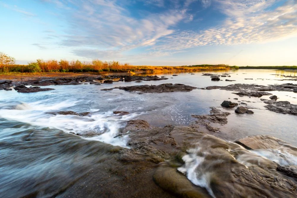
The Mary River Wetlands, situated approximately 150 kilometers east of Darwin in Australia’s Northern Territory, represent one of the most significant and biodiverse ecological systems in the Asia-Pacific region. Renowned for harboring the highest concentration of estuarine crocodiles (Crocodylus porosus) in the world, the region serves as a vital sanctuary for avian life, a premier destination for recreational angling, and a living monument to the grueling history of Australian exploration. Spanning a vast landscape of lily-fringed lagoons, verdant floodplains, and dense monsoon forests, the Mary River National Park operates as a critical buffer between the arid interior of the continent and the tidal reaches of the Arafura Sea.
Ecological Framework and the Shady Camp Infrastructure
At the center of the Mary River’s complex hydrological system is Shady Camp, a location that serves as both a logistical hub for visitors and a point of significant environmental intervention. In the late 1980s, the Northern Territory government commissioned the construction of a barrage—a low-walled concrete dam—designed to mitigate the ingress of saltwater into the upstream freshwater wetlands. This intervention was prompted by the degradation of vast tracts of Melaleuca (paperbark) forests, which were being decimated by rising salinity levels.
The barrage has created an artificial but ecologically fascinating boundary. While it effectively restricts the flow of salt water, it does not act as a total barrier for the region’s apex predators. Estuarine crocodiles are frequently observed traversing the structure, moving between the tidal salt flats and the freshwater billabongs. This convergence creates a unique spectacle during the "run-off"—the period at the end of the wet season (typically March to May) when floodwaters recede from the plains into the river channels. The resulting rush of water over the Shady Camp barrage attracts massive schools of barramundi (Lates calcarifer), which in turn draws both human anglers and large crocodiles in a competitive display of predatory behavior.
The Economic Impact of the Barramundi Industry
Recreational fishing is a cornerstone of the Northern Territory’s tourism economy. According to data from the Northern Territory Department of Industry, Tourism and Trade, fishing-related tourism contributes more than $270 million annually to the local economy. The Mary River system is a primary driver of this revenue. The allure of catching a "metery"—a barramundi exceeding one meter in length—brings thousands of interstate and international visitors to the region each year.
The "run-off" period is particularly lucrative for local charter operators and lodges. During these months, the convergence of baitfish and predators at the Shady Camp barrage creates a world-class fishing theater. However, the presence of high-density crocodile populations necessitates strict adherence to "Croc-Wise" safety protocols. Authorities emphasize that despite the proximity of anglers to the water, the Mary River remains a "high-risk" zone where human-crocodile interactions must be managed through education and physical distancing.
Historical Chronology: From Stuart’s Expedition to Modern Conservation
The history of the Mary River is inextricably linked to the European exploration of the Australian continent. In 1862, the explorer John McDouall Stuart led the first successful expedition to cross the Australian continent from south to north, passing through the center. After a grueling 3,540-kilometer journey from Port Augusta, Stuart and his party reached the Mary River.
- July 1862: Stuart’s party arrives at the banks of the Mary River, naming "Shady Camp" as a place of respite before the final push to the coast.
- July 24, 1862: Stuart reaches the Arafura Sea at Chambers Bay, marking the completion of his transcontinental mission. This feat paved the way for the Australian Overland Telegraph Line.
- 1960s-1970s: The region becomes a focus for the pastoral industry, with water buffalo introduced to the wetlands.
- 1980s: Environmental realization of the damage caused by feral buffalo and saltwater intrusion leads to the construction of the Shady Camp barrage.
- 2000s: The formalization of the Mary River National Park ensures the protection of the wetlands under the Territory Parks and Wildlife Act.
Today, visitors can follow Stuart’s footsteps via the Point Stuart Road, though access remains highly dependent on seasonal conditions. The 6-kilometer trail to Stuart’s Tree Memorial Cairn offers a historical perspective on the hardships faced by 19th-century explorers in this unforgiving terrain.
Biodiversity and Avian Habitats
Beyond its reputation for crocodiles and fish, the Mary River Wetlands are a critical habitat for migratory and resident bird species. The region’s billabongs, such as Mistake Billabong and Rockhole Billabong, provide permanent water sources during the harsh dry season.
The "auditorium" of the wetlands, as described by naturalists, includes the Comb-crested Jacana, colloquially known as the "Jesus bird" for its ability to walk on floating lily pads. Large flocks of Magpie Geese (Anseranas semipalmata) are a signature sight, often numbering in the thousands. The Jabiru, Australia’s only stork species, is frequently seen foraging in the shallows. The biodiversity extends to the monsoon forests, where the orange-footed scrub fowl constructs massive nesting mounds that can reach several meters in height and diameter. These forests, including the Jimmy Creek and Brian Creek tracts, offer a distinct microclimate that supports banyan trees and various species of epiphytic ferns.
Management and Official Responses
The Northern Territory Parks and Wildlife Commission is tasked with the dual responsibility of conservation and public safety. Management plans for the Mary River National Park focus on three primary pillars: feral animal control, weed management, and crocodile population monitoring.
Official statements from the Commission emphasize the importance of sustainable tourism. "The Mary River represents a delicate balance between a high-value recreational asset and a sensitive ecological zone," a spokesperson noted in a recent management review. "Our goal is to maintain the integrity of the freshwater systems while allowing the public to experience the raw power of the Top End’s wildlife."
One of the significant challenges remains the management of Mimosa pigra, an invasive woody weed that threatens to choke the open floodplains. Continuous eradication programs are required to prevent the weed from transforming the diverse wetlands into a monoculture, which would significantly reduce the available habitat for waterbirds.
Infrastructure and Visitor Logistics
For the modern traveler, the Mary River Wetlands offer a range of experiences from rustic "bush camping" to luxury eco-lodging.
- Accommodation: Point Stuart Wilderness Lodge serves as the primary commercial hub, offering lodge rooms and safari tents. The lodge also facilitates the region’s tourism economy through boat rentals and guided fishing safaris.
- Public Camping: The National Park provides managed campgrounds at Couzens Lookout and Shady Camp. These facilities are designed to be "low-impact," requiring visitors to bring their own water and manage their waste.
- Accessibility: While the Arnhem Highway provides year-round access to the park’s boundaries, the internal tracks—specifically the 4WD routes to Point Stuart—are typically closed during the wet season (October to April) due to flooding.
The cost of entry is regulated via a park pass system, with revenues reinvested into the maintenance of boardwalks, viewing shelters, and conservation efforts.
Broader Implications for Wetland Conservation
The Mary River Wetlands serve as a barometer for the environmental health of northern Australia. As global sea levels rise, the threat of saltwater intrusion into freshwater systems becomes more acute. The Mary River’s history of barrage construction and floodplain management provides valuable data for environmental scientists studying coastal resilience.
Furthermore, the park’s success as a tourism destination demonstrates a viable model for "consumptive" (fishing) and "non-consumptive" (birdwatching) tourism co-existing within a protected area. By valuing the wetlands both for their ecological services and their economic output, the Northern Territory provides a template for the preservation of similar tropical river systems globally.
The Mary River’s ability to "guard its secret" despite its proximity to a capital city lies in its seasonal volatility. The dramatic shift between the flooded "Wet" and the parched "Dry" ensures that the landscape is constantly reinventing itself, demanding respect from those who navigate its waters. For the anglers on the barrage and the campers under the stars, the Mary River remains a place where the primitive forces of nature remain firmly in control.